Approximate Location Map
Large Map »
Latitude: 51.5178 / 51°31'4"N
Longitude: 0.191 / 0°11'27"E
OS Eastings: 552115
OS Northings: 182153
OS Grid: TQ521821
Mapcode National: GBR SP.4TN
Mapcode Global: VHHNM.83BS
Plus Code: 9F32G59R+49
Entry Name: Stable Block at Rainham Hall
Listing Date: 7 January 1955
Grade: II*
Source: Historic England
Source ID: 1183554
English Heritage Legacy ID: 201554
ID on this website: 101183554
Location: Rainham, Havering, London, RM13
County: London
District: Havering
Electoral Ward/Division: Rainham and Wennington
Parish: Non Civil Parish
Built-Up Area: Havering
Traditional County: Essex
Lieutenancy Area (Ceremonial County): Greater London
Church of England Parish: Rainham
Church of England Diocese: Chelmsford
Tagged with: Stable
BROADWAY
1.
5017
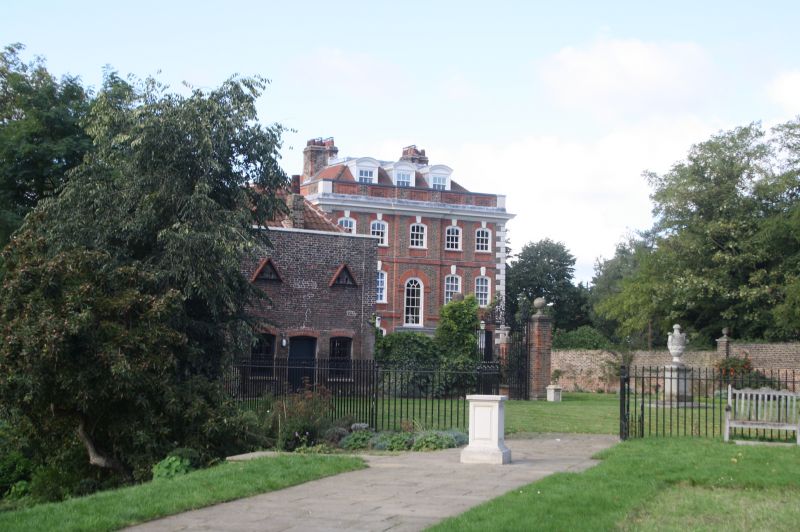
Rainham
Stable block at
Rainham Hall
TQ 5282/5382 6/2C 7.1.55
II* GV
2.
C18. Stock brick, one lofty storey. Parapet, pantile roof. Two round headed
coach arches of red rubbed brick.
Listing NGR: TQ5211582153
External links are from the relevant listing authority and, where applicable, Wikidata. Wikidata IDs may be related buildings as well as this specific building. If you want to add or update a link, you will need to do so by editing the Wikidata entry.


Other nearby listed buildings
