Approximate Location Map
Large Map »
Latitude: 51.4426 / 51°26'33"N
Longitude: -1.6052 / 1°36'18"W
OS Eastings: 427532
OS Northings: 171581
OS Grid: SU275715
Mapcode National: GBR 5YC.GZ8
Mapcode Global: VHC1R.407G
Plus Code: 9C3WC9VV+2W
Entry Name: 2, High Street
Listing Date: 22 August 1966
Grade: II
Source: Historic England
Source ID: 1183780
English Heritage Legacy ID: 310661
ID on this website: 101183780
Location: Ramsbury, Wiltshire, SN8
County: Wiltshire
Civil Parish: Ramsbury
Built-Up Area: Ramsey
Traditional County: Wiltshire
Lieutenancy Area (Ceremonial County): Wiltshire
Tagged with: Building
SU 27 SE RAMSBURY HIGH STREET
(north side)
10/203 No 2
22.8.66
II
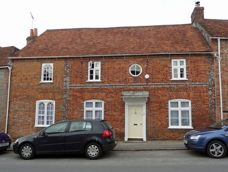
House. Early - mid C19. Red brick with vitrified quoins and bands
at floor level. Tiled roof. 2-storey, 4 bays, originally 3 bays
with central stair hall, and later C19 bay added left. 6-panel door
with bracketed canopy. Casement windows with upper fixed light
within segmental gauged brick lintels. Oculus over door. Bay to
left has early C20 arch headed lights. Brick dentilled eaves.
Stack removed.
Listing NGR: SU2753471581
External links are from the relevant listing authority and, where applicable, Wikidata. Wikidata IDs may be related buildings as well as this specific building. If you want to add or update a link, you will need to do so by editing the Wikidata entry.


Other nearby listed buildings
