Approximate Location Map
Large Map »
Latitude: 51.0717 / 51°4'18"N
Longitude: 1.0854 / 1°5'7"E
OS Eastings: 616245
OS Northings: 134791
OS Grid: TR162347
Mapcode National: GBR V0L.R7G
Mapcode Global: FRA F659.0P9
Plus Code: 9F3333CP+M4
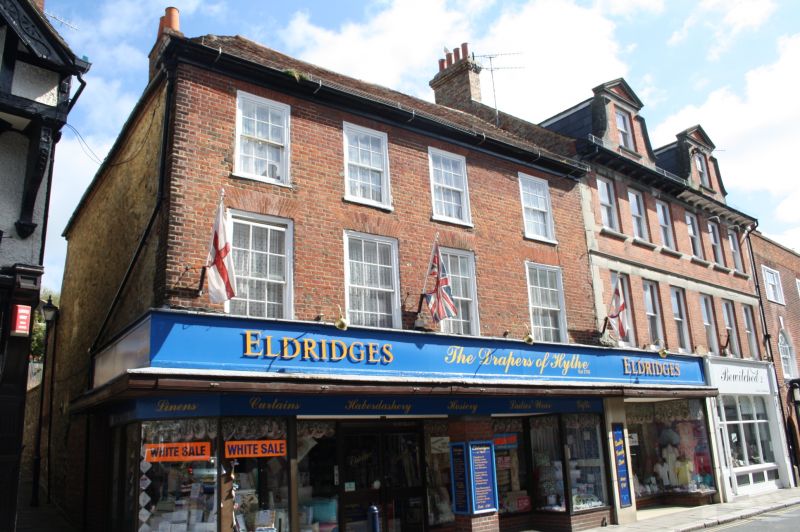
Entry Name: 87, High Street
Listing Date: 21 December 1973
Grade: II
Source: Historic England
Source ID: 1185860
English Heritage Legacy ID: 175111
ID on this website: 101185860
Location: Hythe, Folkestone and Hythe, Kent, CT21
County: Kent
District: Folkestone and Hythe
Civil Parish: Hythe
Built-Up Area: Hythe
Traditional County: Kent
Lieutenancy Area (Ceremonial County): Kent
Tagged with: Building
1.
1255 HIGH STREET
(North Side)
No 87
TR 1634 NW 2/9
II
2.
C18. 3 storeys. Red brick front, west walls are of stone rubble. Hipped tiled
roof Eaves cornice. 4 sashes with glazing bars intact on the upper floors.
Modern shop fronts.
Listing NGR: TR1624634798
External links are from the relevant listing authority and, where applicable, Wikidata. Wikidata IDs may be related buildings as well as this specific building. If you want to add or update a link, you will need to do so by editing the Wikidata entry.


Other nearby listed buildings
