Approximate Location Map
Large Map »
Latitude: 52.4616 / 52°27'41"N
Longitude: 1.5635 / 1°33'48"E
OS Eastings: 642178
OS Northings: 290827
OS Grid: TM421908
Mapcode National: GBR XMD.L4S
Mapcode Global: VHM6K.1DY8
Plus Code: 9F43FH67+MC
Entry Name: The Staithe
Listing Date: 22 September 1971
Grade: II
Source: Historic England
Source ID: 1186930
English Heritage Legacy ID: 363013
ID on this website: 101186930
Location: Beccles, East Suffolk, NR34
County: Suffolk
District: East Suffolk
Civil Parish: Beccles
Built-Up Area: Beccles
Traditional County: Suffolk
Lieutenancy Area (Ceremonial County): Suffolk
Church of England Parish: Beccles St Michael and Saint Luke
Church of England Diocese: St.Edmundsbury and Ipswich
Tagged with: Architectural structure
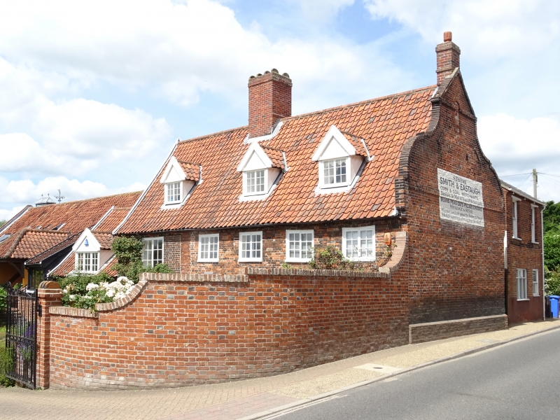
NORTHGATE
1.
828
(West Side)
TM 4290 2/85 The Staithe
II
2.
17th century, altered. Red brick with band and Dutch gable. 2 storey and
attic. 3 dormers. Pantiles. 5 windows, casements in flush frames.
6-panel entrance door.
Listing NGR: TM4220590802
External links are from the relevant listing authority and, where applicable, Wikidata. Wikidata IDs may be related buildings as well as this specific building. If you want to add or update a link, you will need to do so by editing the Wikidata entry.


Other nearby listed buildings
