Approximate Location Map
Large Map »
Latitude: 52.5956 / 52°35'44"N
Longitude: -2.5575 / 2°33'27"W
OS Eastings: 362330
OS Northings: 299902
OS Grid: SO623999
Mapcode National: GBR BS.9H35
Mapcode Global: WH9DM.P0BZ
Plus Code: 9C4VHCWR+6X
Entry Name: 3 and 4, High Street
Listing Date: 1 February 1974
Grade: II
Source: Historic England
Source ID: 1189097
English Heritage Legacy ID: 254799
ID on this website: 101189097
Location: Much Wenlock, Shropshire, TF13
County: Shropshire
Civil Parish: Much Wenlock
Built-Up Area: Much Wenlock
Traditional County: Shropshire
Lieutenancy Area (Ceremonial County): Shropshire
Church of England Parish: Much Wenlock with Bourton
Church of England Diocese: Hereford
Tagged with: Building
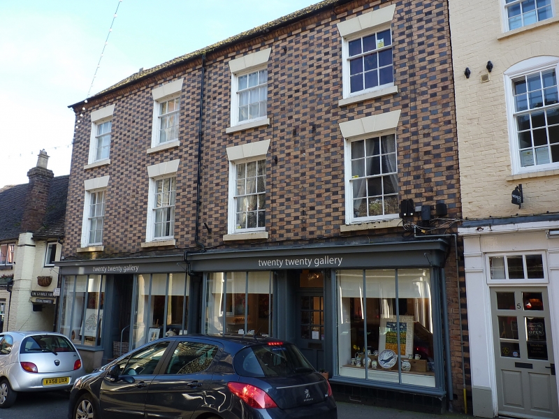
1.
1954 MUCH WENLOCK
HIGH STREET
(South Side)
Nos 3 and 4
SO 69 NW (SJ 6200) 6/37
II GV
2.
Early C19. Blue and buff chequered brick; 3 storeys; 4 sash windows with
keyblocks and plain lintels; corbelled eaves; old tiles. Late C19 shop
fronts. Included for group value.
Nos 1 to 6 (consec) form a group
Listing NGR: SO6233499905
External links are from the relevant listing authority and, where applicable, Wikidata. Wikidata IDs may be related buildings as well as this specific building. If you want to add or update a link, you will need to do so by editing the Wikidata entry.


Other nearby listed buildings
