Approximate Location Map
Large Map »
Latitude: 52.867 / 52°52'1"N
Longitude: -2.0966 / 2°5'47"W
OS Eastings: 393596
OS Northings: 329949
OS Grid: SJ935299
Mapcode National: GBR 27H.BRC
Mapcode Global: WHBDM.R6TF
Plus Code: 9C4VVW83+Q9
Entry Name: Gate Piers of Burston Hall
Listing Date: 25 April 1980
Grade: II
Source: Historic England
Source ID: 1189651
English Heritage Legacy ID: 272273
ID on this website: 101189651
Location: Burston, Stafford, Staffordshire, ST18
County: Staffordshire
District: Stafford
Civil Parish: Sandon and Burston
Traditional County: Staffordshire
Lieutenancy Area (Ceremonial County): Staffordshire
Church of England Parish: Sandon All Saints
Church of England Diocese: Lichfield
Tagged with: Gatepost
SANDON BURSTON
1.
5373
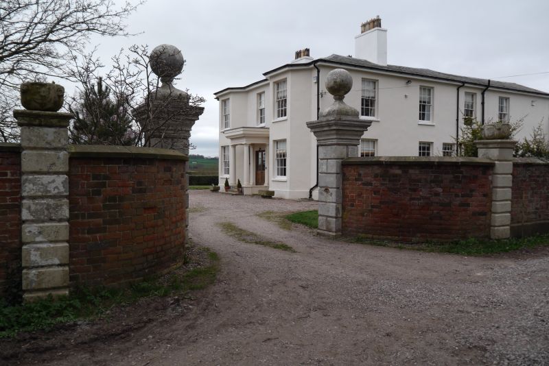
Gate piers of
Burston Hall
SJ 92 NW 15/28
II
2.
C18. Gate piers of the earlier house which was demolished early C19. A pair
of stone rusticated gate piers with moulded cornice caps and ball finials.
Listing NGR: SJ9359629949
External links are from the relevant listing authority and, where applicable, Wikidata. Wikidata IDs may be related buildings as well as this specific building. If you want to add or update a link, you will need to do so by editing the Wikidata entry.


Other nearby listed buildings
