Approximate Location Map
Large Map »
Latitude: 54.2331 / 54°13'59"N
Longitude: -1.3441 / 1°20'38"W
OS Eastings: 442850
OS Northings: 482133
OS Grid: SE428821
Mapcode National: GBR MM1H.S9
Mapcode Global: WHD8H.BV5P
Plus Code: 9C6W6MM4+69
Entry Name: 10 and 12, Kirkgate
Listing Date: 15 June 1984
Grade: II
Source: Historic England
Source ID: 1190584
English Heritage Legacy ID: 333301
ID on this website: 101190584
Location: Thirsk, North Yorkshire, YO7
County: North Yorkshire
District: Hambleton
Civil Parish: Thirsk
Built-Up Area: Thirsk
Traditional County: Yorkshire
Lieutenancy Area (Ceremonial County): North Yorkshire
Tagged with: Building
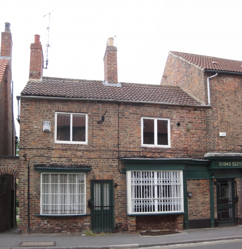
SE 4282 THIRSK KIRKGATE
6/60 (east side)
GV Nos 10 and 12
II
Originally a two-bay cottage, now divided into 2 with shop fronts. Brown local brick.
Dentilled eaves. Pantile roof. 2 storeys. No 10 has a C19 square bay window with
glazing bars, a doorcase with dentilled cornice and a sliding sash window to the first
floor. No 12 has an early C19 bow window with a fixed light and an upper window with
later glazing.
Listing NGR: SE4285182137
External links are from the relevant listing authority and, where applicable, Wikidata. Wikidata IDs may be related buildings as well as this specific building. If you want to add or update a link, you will need to do so by editing the Wikidata entry.


Other nearby listed buildings
