Approximate Location Map
Large Map »
Latitude: 53.4296 / 53°25'46"N
Longitude: -1.1166 / 1°6'59"W
OS Eastings: 458792
OS Northings: 392901
OS Grid: SK587929
Mapcode National: GBR NXNS.19
Mapcode Global: WHDDN.T2G3
Plus Code: 9C5WCVHM+V9
Entry Name: Rockhouse
Listing Date: 22 January 1981
Grade: II
Source: Historic England
Source ID: 1191907
English Heritage Legacy ID: 334411
ID on this website: 101191907
Location: Tickhill, Doncaster, South Yorkshire, DN11
County: Doncaster
Civil Parish: Tickhill
Built-Up Area: Tickhill
Traditional County: Yorkshire
Lieutenancy Area (Ceremonial County): South Yorkshire
Church of England Parish: Tickhill St Mary
Church of England Diocese: Sheffield
Tagged with: Building
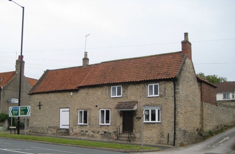
WESTGATE
1. (north side)
5096 ------------
Rockhouse
SK 5892 5/126
II
2.
Cl8, with early Cl9 extension to west. Magnesian limestone rubble. Pantiled
roof. Two storeys. Two bays with 2-bay extension: modern windows. windows.'
Listing NGR: SK5879292901
External links are from the relevant listing authority and, where applicable, Wikidata. Wikidata IDs may be related buildings as well as this specific building. If you want to add or update a link, you will need to do so by editing the Wikidata entry.


Other nearby listed buildings
