Approximate Location Map
Large Map »
Latitude: 51.5747 / 51°34'28"N
Longitude: -0.3365 / 0°20'11"W
OS Eastings: 515378
OS Northings: 187512
OS Grid: TQ153875
Mapcode National: GBR 63.HVR
Mapcode Global: VHGQH.3PZ6
Plus Code: 9C3XHMF7+VC
Entry Name: The Grove
Listing Date: 21 September 1951
Grade: II
Source: Historic England
Source ID: 1192932
English Heritage Legacy ID: 201997
ID on this website: 101192932
Location: Harrow, London, HA1
County: London
District: Harrow
Electoral Ward/Division: Harrow on the Hill
Parish: Non Civil Parish
Built-Up Area: Harrow
Traditional County: Middlesex
Lieutenancy Area (Ceremonial County): Greater London
Church of England Parish: St Mary Harrow-on-the-Hill
Church of England Diocese: London
Tagged with: Architectural structure
CHURCH HILL
1.
5016
Harrow-on-the-Hill
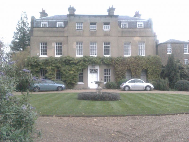
The Grove
TQ 1587 NW 13/52
TQ 1587 SW 16/52 21.9.51
II
2.
Mid C18. Stuccoed two and a half-storeys. seven windows. Good flat-topped doorcase.
Early C19 additions on north and east in a plain dark brick.
Listing NGR: TQ1537587510
External links are from the relevant listing authority and, where applicable, Wikidata. Wikidata IDs may be related buildings as well as this specific building. If you want to add or update a link, you will need to do so by editing the Wikidata entry.


Other nearby listed buildings
