Approximate Location Map
Large Map »
Latitude: 51.616 / 51°36'57"N
Longitude: -0.3159 / 0°18'57"W
OS Eastings: 516697
OS Northings: 192143
OS Grid: TQ166921
Mapcode National: GBR 6V.WK3
Mapcode Global: VHGQ9.GNV0
Plus Code: 9C3XJM8M+CJ
Entry Name: Grave of W S Gilbert to South West of Church of St John
Listing Date: 25 May 1983
Grade: II
Source: Historic England
Source ID: 1193140
English Heritage Legacy ID: 202017
ID on this website: 101193140
Location: St John's Church, Stanmore, Harrow, London, HA7
County: London
District: Harrow
Electoral Ward/Division: Stanmore Park
Parish: Non Civil Parish
Built-Up Area: Harrow
Traditional County: Middlesex
Lieutenancy Area (Ceremonial County): Greater London
Church of England Parish: St John the Evangelist Great Stanmore
Church of England Diocese: London
Tagged with: Tombstone
CHURCH ROAD
1.
5016
Stanmore
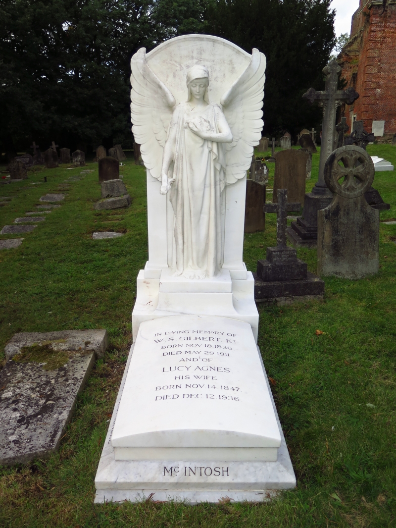
Grave of W S Gilbert to south-
west of Church of St John
TQ 1692 SE 8/8D
II
2.
1911. White marble. Angel with wings displayed above cambered slab and chamferred
base.
Listing NGR: TQ1669792143
External links are from the relevant listing authority and, where applicable, Wikidata. Wikidata IDs may be related buildings as well as this specific building. If you want to add or update a link, you will need to do so by editing the Wikidata entry.


Other nearby listed buildings
