Approximate Location Map
Large Map »
Latitude: 51.4735 / 51°28'24"N
Longitude: -0.2481 / 0°14'52"W
OS Eastings: 521773
OS Northings: 176409
OS Grid: TQ217764
Mapcode National: GBR 9N.VJ3
Mapcode Global: VHGR3.N776
Plus Code: 9C3XFQF2+CQ
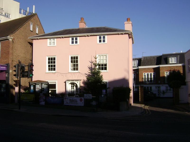
Entry Name: 70, High Street SW13
Listing Date: 5 August 1974
Grade: II
Source: Historic England
Source ID: 1193550
English Heritage Legacy ID: 205426
ID on this website: 101193550
Location: Barnes, Richmond upon Thames, London, SW13
County: London
District: Richmond upon Thames
Electoral Ward/Division: Barnes
Parish: Non Civil Parish
Built-Up Area: Richmond upon Thames
Traditional County: Surrey
Lieutenancy Area (Ceremonial County): Greater London
Church of England Parish: Barnes St Mary
Church of England Diocese: Southwark
Tagged with: Building
1.
5028
TQ 2176
12/18
5.8.74
HIGH STREET
(north side)
Barnes, SW13
No 70
II
2.
C17, C19 house. Three storeys. Three windows wide. Hipped slate roof with eaves.
Walls roughcast. Square headed sash windows with moulded frames. Upper storeys
retain glazing bars.
Listing NGR: TQ2177376409
External links are from the relevant listing authority and, where applicable, Wikidata. Wikidata IDs may be related buildings as well as this specific building. If you want to add or update a link, you will need to do so by editing the Wikidata entry.


Other nearby listed buildings
