Approximate Location Map
Large Map »
Latitude: 52.0487 / 52°2'55"N
Longitude: 0.9485 / 0°56'54"E
OS Eastings: 602276
OS Northings: 243023
OS Grid: TM022430
Mapcode National: GBR SL9.DMF
Mapcode Global: VHKF7.DR9V
Plus Code: 9F422WXX+F9
Entry Name: 38 and 40, Bridge Street
Listing Date: 22 May 1972
Grade: II
Source: Historic England
Source ID: 1193972
English Heritage Legacy ID: 277620
ID on this website: 101193972
Location: Hadleigh, Babergh, Suffolk, IP7
County: Suffolk
District: Babergh
Civil Parish: Hadleigh
Built-Up Area: Hadleigh
Traditional County: Suffolk
Lieutenancy Area (Ceremonial County): Suffolk
Church of England Parish: Hadleigh St Mary
Church of England Diocese: St.Edmundsbury and Ipswich
Tagged with: Building
1.
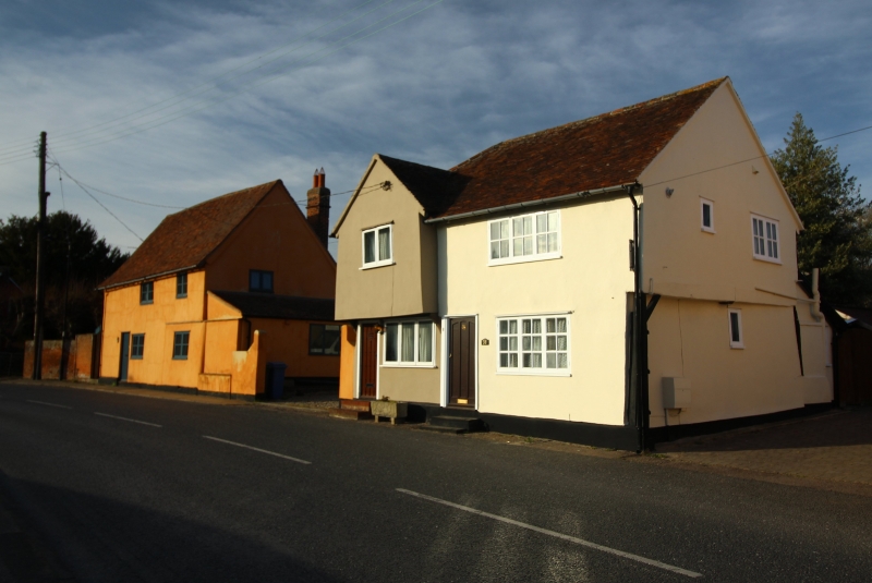
1161 BRIDGE STREET
(North East Side)
Nos 38 & 40
TM 04 SW 1/60
II GV
2.
Probably C16/C17 house. Extensively reconditioned, now 2 cottages.
2 storey timber framed and plastered, roofs tiled, Cross wing with
upper storey projecting on front on curved brackets, at North end.
NMR photos,
Nos 28 to 44 (even) and the White Hart Inn form a group.
Listing NGR: TM0227643023
External links are from the relevant listing authority and, where applicable, Wikidata. Wikidata IDs may be related buildings as well as this specific building. If you want to add or update a link, you will need to do so by editing the Wikidata entry.


Other nearby listed buildings
