Approximate Location Map
Large Map »
Latitude: 51.0403 / 51°2'25"N
Longitude: -0.1845 / 0°11'4"W
OS Eastings: 527379
OS Northings: 128343
OS Grid: TQ273283
Mapcode National: GBR JLC.N65
Mapcode Global: FRA B6HC.HYD
Plus Code: 9C3X2RR8+46
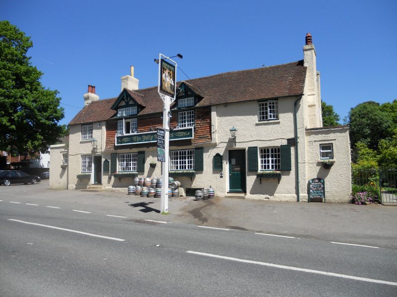
Entry Name: The Jolly Tanners Public House
Listing Date: 11 May 1983
Grade: II
Source: Historic England
Source ID: 1194106
English Heritage Legacy ID: 302492
ID on this website: 101194106
Location: Staplefield, Mid Sussex, RH17
County: West Sussex
District: Mid Sussex
Civil Parish: Ansty and Staplefield
Traditional County: Sussex
Lieutenancy Area (Ceremonial County): West Sussex
Church of England Parish: Staplefield Common St Mark
Church of England Diocese: Chichester
Tagged with: Pub
CUCKFIELD RURAL HANDCROSS ROAD
1.
5405
Staplefield
The Jolly Tanners
Public House
TQ 22 NE 10/305
II
2.
Early C19. Two storeys. Four windows. Faced with roughcast the centre of the
first floor windows extended to form dormers. Tiled roof. Casement windows, with
pointed Gothic panes.
Listing NGR: TQ2737928343
External links are from the relevant listing authority and, where applicable, Wikidata. Wikidata IDs may be related buildings as well as this specific building. If you want to add or update a link, you will need to do so by editing the Wikidata entry.


Other nearby listed buildings
