Approximate Location Map
Large Map »
Latitude: 52.409 / 52°24'32"N
Longitude: 0.7534 / 0°45'12"E
OS Eastings: 587380
OS Northings: 282567
OS Grid: TL873825
Mapcode National: GBR RD7.Z64
Mapcode Global: VHKCD.0QN3
Plus Code: 9F42CQ53+J9
Entry Name: Nuns Bridge Central
Listing Date: 1 December 1993
Grade: II
Source: Historic England
Source ID: 1195911
English Heritage Legacy ID: 384789
ID on this website: 101195911
Location: Thetford, Breckland, Norfolk, IP24
County: Norfolk
District: Breckland
Civil Parish: Thetford
Built-Up Area: Thetford
Traditional County: Norfolk
Lieutenancy Area (Ceremonial County): Norfolk
Church of England Parish: Thetford St Cuthbert
Church of England Diocese: Norwich
Tagged with: Bridge
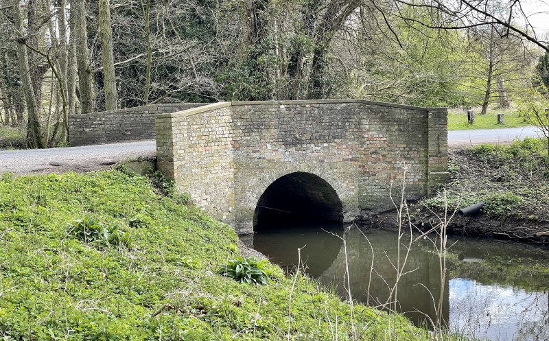
THETFORD
TL8782 NUNS BRIDGES ROAD
617-1/8/119 Nuns Bridge Central
GV II
Road over river bridge (Thet spring). Early C19. Gault brick.
Single semi-circular arch with splayed rebuilt brick parapets.
The centre of 3 bridges occupying position of crossing point
of Icknield way, first used c3000 BC.
Listing NGR: TL8738082567
External links are from the relevant listing authority and, where applicable, Wikidata. Wikidata IDs may be related buildings as well as this specific building. If you want to add or update a link, you will need to do so by editing the Wikidata entry.


Other nearby listed buildings
