Approximate Location Map
Large Map »
Latitude: 53.5292 / 53°31'45"N
Longitude: -2.9577 / 2°57'27"W
OS Eastings: 336615
OS Northings: 404043
OS Grid: SD366040
Mapcode National: GBR 7WSM.GL
Mapcode Global: WH86N.JKT9
Plus Code: 9C5VG2HR+MW
Entry Name: Lydiate Bridge
Listing Date: 17 January 1986
Grade: II
Source: Historic England
Source ID: 1199419
English Heritage Legacy ID: 216485
ID on this website: 101199419
Location: Lydiate, Sefton, Merseyside, L31
County: Sefton
Civil Parish: Lydiate
Built-Up Area: Maghull
Traditional County: Lancashire
Lieutenancy Area (Ceremonial County): Merseyside
Church of England Parish: Lydiate and Downholland, Saint Thomas
Church of England Diocese: Liverpool
Tagged with: Bridge
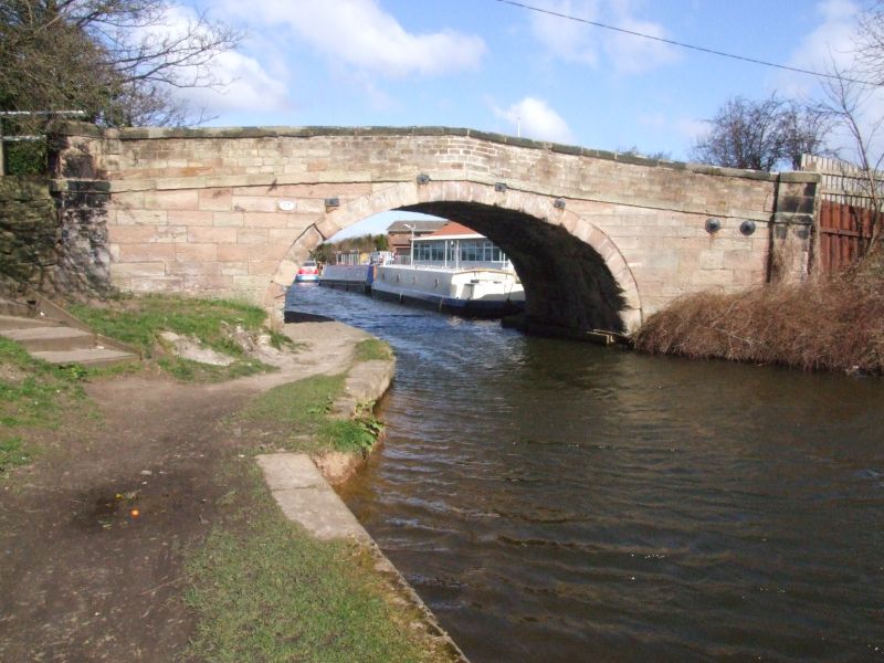
LYDIATE PILLING LANE
SD 30 SE
7/86 Lydiate Bridge
II
Bridge over Leeds and Liverpool Canal. c.1770. Stone.
Elliptical arch, with band over and coped parapet. End
pilaster strips. Plaque inscribed "NO17" on north side.
Listing NGR: SD3661504043
External links are from the relevant listing authority and, where applicable, Wikidata. Wikidata IDs may be related buildings as well as this specific building. If you want to add or update a link, you will need to do so by editing the Wikidata entry.


Other nearby listed buildings
