Approximate Location Map
Large Map »
Latitude: 51.6579 / 51°39'28"N
Longitude: -1.583 / 1°34'58"W
OS Eastings: 428943
OS Northings: 195538
OS Grid: SU289955
Mapcode National: GBR 5VW.2LP
Mapcode Global: VHC0L.JL0F
Plus Code: 9C3WMC58+5R
Entry Name: 6, London Street
Listing Date: 10 July 1986
Grade: II
Source: Historic England
Source ID: 1199520
English Heritage Legacy ID: 249423
ID on this website: 101199520
Location: Faringdon, Vale of White Horse, Oxfordshire, SN7
County: Oxfordshire
District: Vale of White Horse
Civil Parish: Great Faringdon
Built-Up Area: Faringdon
Traditional County: Berkshire
Lieutenancy Area (Ceremonial County): Oxfordshire
Church of England Parish: Faringdon
Church of England Diocese: Oxford
Tagged with: Building
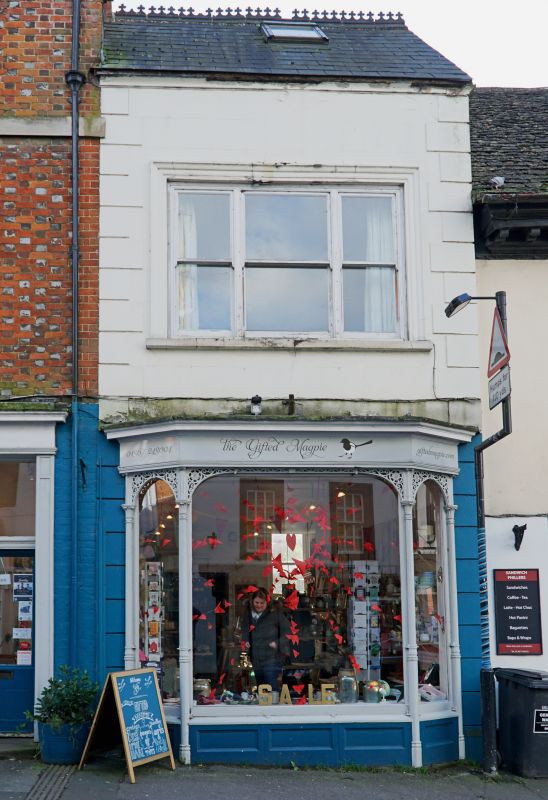
GREAT FARINGDON LONDON STREET
SU 2895 (south side)
3/102 No 6
-
GV II
Mid to later C19 narrow stucco faced shop. 2-storey with slate roof. Quoins.
1-window range. Ground floor fine projecting cast iron shopfront, 3-sided with
slim fluted shafts, leaf capitals and pierced spandrels. Listed for shopfront.
Listing NGR: SU2905295542
External links are from the relevant listing authority and, where applicable, Wikidata. Wikidata IDs may be related buildings as well as this specific building. If you want to add or update a link, you will need to do so by editing the Wikidata entry.


Other nearby listed buildings
