Approximate Location Map
Large Map »
Latitude: 51.4784 / 51°28'42"N
Longitude: -1.6215 / 1°37'17"W
OS Eastings: 426385
OS Northings: 175556
OS Grid: SU263755
Mapcode National: GBR 5XY.BVP
Mapcode Global: VHC1J.V35J
Plus Code: 9C3WF9HH+8C
Entry Name: 11, Castle Street
Listing Date: 22 August 1966
Grade: II
Source: Historic England
Source ID: 1199626
English Heritage Legacy ID: 310474
ID on this website: 101199626
Location: Aldbourne, Wiltshire, SN8
County: Wiltshire
Civil Parish: Aldbourne
Built-Up Area: Aldbourne
Traditional County: Wiltshire
Lieutenancy Area (Ceremonial County): Wiltshire
Tagged with: Building
SU 27 NE
9/14
22.8.66
ALDBOURNE
CASTLE STREET
(south side)
No 11
II
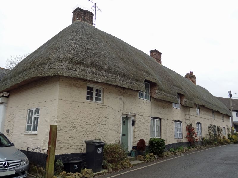
House, C18. Stone rubble with thatched roof. 1 storey and attic, 3
bays, door in left bay up 2 steps; boarded with wide frame and
timber lintel. Timber 12-pane casement windows with segmental brick
heads. 2 flush dormers. Roof hipped to left with stack to first bay
and at right end.
Listing NGR: SU2638575556
External links are from the relevant listing authority and, where applicable, Wikidata. Wikidata IDs may be related buildings as well as this specific building. If you want to add or update a link, you will need to do so by editing the Wikidata entry.


Other nearby listed buildings
