Approximate Location Map
Large Map »
Latitude: 51.8146 / 51°48'52"N
Longitude: -1.6242 / 1°37'27"W
OS Eastings: 426002
OS Northings: 212957
OS Grid: SP260129
Mapcode National: GBR 5SW.46K
Mapcode Global: VHBZS.SNQ8
Plus Code: 9C3WR97G+V8
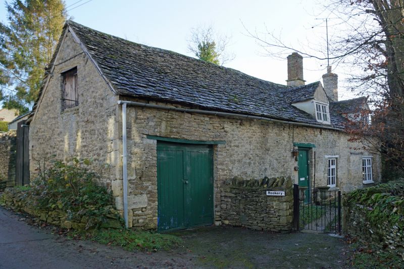
Entry Name: The Rookery
Listing Date: 21 August 1989
Grade: II
Source: Historic England
Source ID: 1199907
English Heritage Legacy ID: 253591
ID on this website: 101199907
Location: Fulbrook, West Oxfordshire, OX18
County: Oxfordshire
District: West Oxfordshire
Civil Parish: Fulbrook
Traditional County: Oxfordshire
Lieutenancy Area (Ceremonial County): Oxfordshire
Church of England Parish: Fulbrook
Church of England Diocese: Oxford
Tagged with: Architectural structure
FULBROOK
SF21SE, SP2512
5/34, 12/34 The Rookery
- II
House. C18. Stone coursed rubble; stone slate roof; stone end stack to right,
ridge stack to right of centre. Single storey and attic; 4-bay range at
right-angles to street. Plank door to centre. Garage doors to left. 2-light
casement to right of centre with wood lintel. 2 gabled dormers to right.
Interior not inspected.
Listing NGR: SP2600212957
External links are from the relevant listing authority and, where applicable, Wikidata. Wikidata IDs may be related buildings as well as this specific building. If you want to add or update a link, you will need to do so by editing the Wikidata entry.


Other nearby listed buildings
