Approximate Location Map
Large Map »
Latitude: 51.0719 / 51°4'18"N
Longitude: 0.6965 / 0°41'47"E
OS Eastings: 589005
OS Northings: 133739
OS Grid: TQ890337
Mapcode National: GBR QW3.NX7
Mapcode Global: FRA D6B9.54S
Plus Code: 9F323MCW+PH
Entry Name: Stace House
Listing Date: 8 May 1950
Grade: II
Source: Historic England
Source ID: 1203636
English Heritage Legacy ID: 179849
ID on this website: 101203636
Location: Tenterden, Ashford, Kent, TN30
County: Kent
District: Ashford
Civil Parish: Tenterden
Built-Up Area: Tenterden
Traditional County: Kent
Lieutenancy Area (Ceremonial County): Kent
Tagged with: House
1.
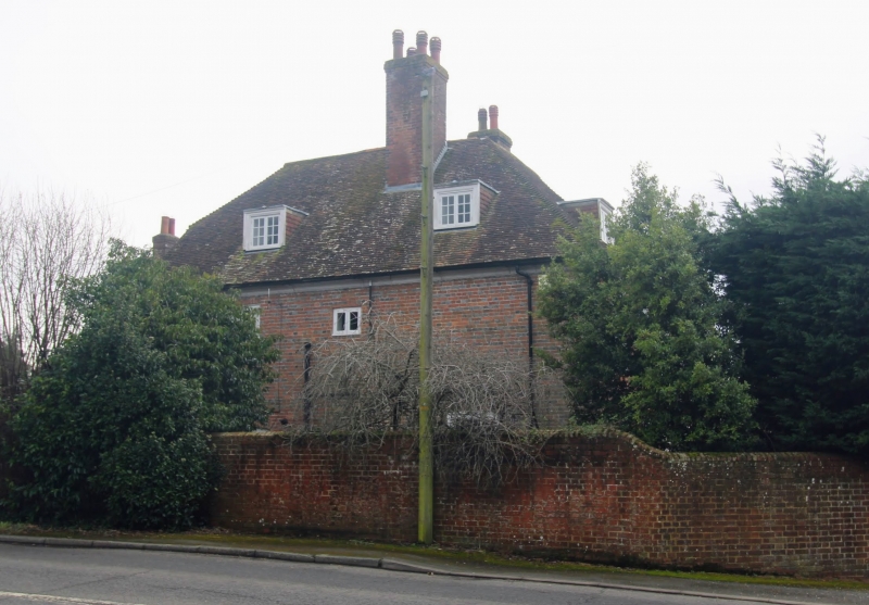
1715 WOODCHURCH ROAD
(South East Side)
Stace House
TQ 8933 1/131 8.5.50.
II
2.
Formerly "The Limes." C18. 2 storeys and attics red brick. Hipped roof
with 2 dormers and eaves cornice. 4 sashes with glazing bars intact and
1 blank. Doorcase with pilasters, pediment, rectangular fanlight and
4-panel moulded door.
Listing NGR: TQ8899833742
External links are from the relevant listing authority and, where applicable, Wikidata. Wikidata IDs may be related buildings as well as this specific building. If you want to add or update a link, you will need to do so by editing the Wikidata entry.


Other nearby listed buildings
