Approximate Location Map
Large Map »
Latitude: 51.3739 / 51°22'26"N
Longitude: 1.3064 / 1°18'23"E
OS Eastings: 630215
OS Northings: 169062
OS Grid: TR302690
Mapcode National: GBR WZW.T95
Mapcode Global: VHLG5.LQJM
Plus Code: 9F3398F4+HH
Entry Name: The Powell Arms Public House
Listing Date: 22 February 1973
Grade: II
Source: Historic England
Source ID: 1204108
English Heritage Legacy ID: 356682
Also known as: Powell Arms
The Powell Arms, Birchington
ID on this website: 101204108
Location: Birchington, Thanet, Kent, CT7
County: Kent
District: Thanet
Civil Parish: Birchington
Built-Up Area: Margate
Traditional County: Kent
Lieutenancy Area (Ceremonial County): Kent
Tagged with: Pub
THE SQUARE
1.
1380
(North Side)
BIRCHINGTON-ON-SEA
No 11
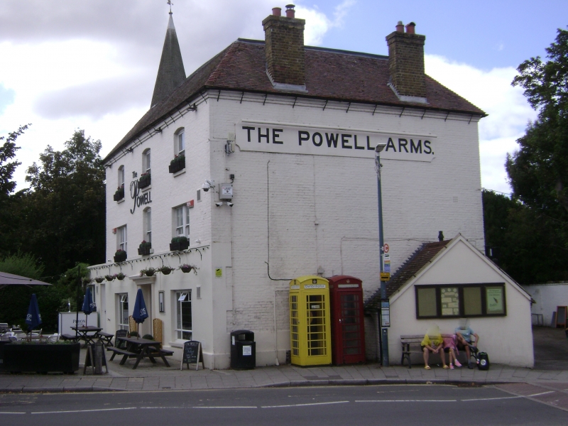
(The Powell Arms Public House)
TR 36 NW 9/300
II
2.
Circa 1840. 3 storeys painted brick. Hipped tiled roof. Guttering
supported on cast iron brackets. 3 cambered sashes, 2 double-hung.
Sashes on lst floor. Modern bar front.
Listing NGR: TR3021569059
External links are from the relevant listing authority and, where applicable, Wikidata. Wikidata IDs may be related buildings as well as this specific building. If you want to add or update a link, you will need to do so by editing the Wikidata entry.


Other nearby listed buildings
