Approximate Location Map
Large Map »
Latitude: 52.8535 / 52°51'12"N
Longitude: -1.4491 / 1°26'56"W
OS Eastings: 437196
OS Northings: 328582
OS Grid: SK371285
Mapcode National: GBR 6FW.0GT
Mapcode Global: WHDH6.QJ5T
Plus Code: 9C4WVH32+99
Entry Name: Churchyard Cross to South of St James' Church
Listing Date: 11 March 1987
Grade: II
Source: Historic England
Source ID: 1205556
English Heritage Legacy ID: 83224
ID on this website: 101205556
Location: St James's Church, Swarkestone, South Derbyshire, DE73
County: Derbyshire
District: South Derbyshire
Civil Parish: Swarkestone
Traditional County: Derbyshire
Lieutenancy Area (Ceremonial County): Derbyshire
Church of England Parish: Swarkestone St James
Church of England Diocese: Derby
Tagged with: Churchyard cross
SK 32 NE
3/238
PARISH OF SWARKESTONE
CHURCH LANE
(East Side)
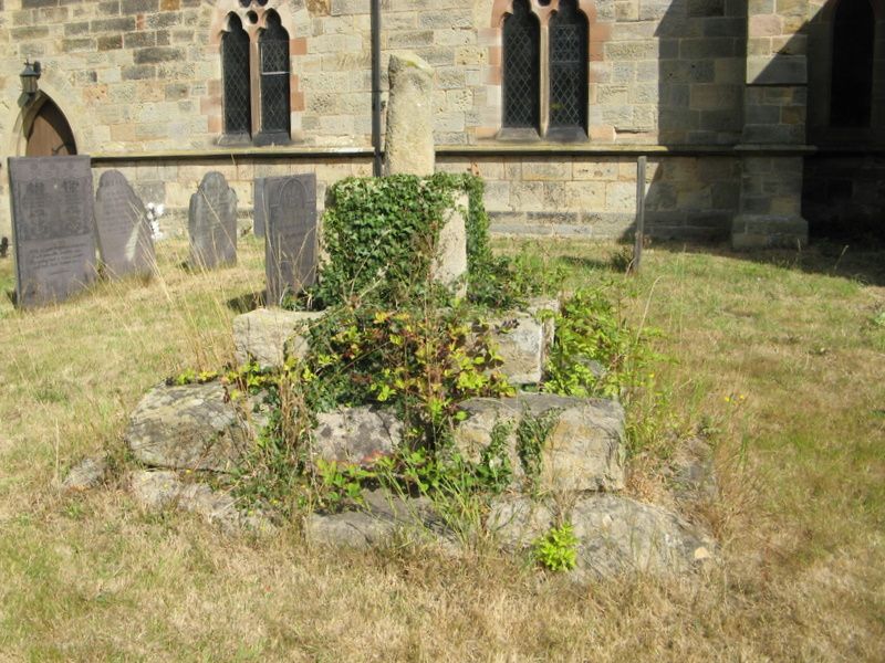
Churchyard Cross to South of St James' Church
GV
II
Churchyard cross. C14. Stone. Large three stepped square
plinth with weathered stump of cross above on square base with
chamfered corners to top.
Listing NGR: SK3719628582
External links are from the relevant listing authority and, where applicable, Wikidata. Wikidata IDs may be related buildings as well as this specific building. If you want to add or update a link, you will need to do so by editing the Wikidata entry.


Other nearby listed buildings
