Approximate Location Map
Large Map »
Latitude: 53.4201 / 53°25'12"N
Longitude: -3.002 / 3°0'7"W
OS Eastings: 333504
OS Northings: 391949
OS Grid: SJ335919
Mapcode National: GBR 70H.MZ
Mapcode Global: WH876.V9ND
Plus Code: 9C5RCXCX+35
Entry Name: Graving Docks
Listing Date: 19 June 1985
Grade: II
Source: Historic England
Source ID: 1206210
English Heritage Legacy ID: 213935
ID on this website: 101206210
Location: Vauxhall, Liverpool, Merseyside, L3
County: Liverpool
Electoral Ward/Division: Kirkdale
Parish: Non Civil Parish
Built-Up Area: Liverpool
Traditional County: Lancashire
Lieutenancy Area (Ceremonial County): Merseyside
Church of England Parish: Liverpool Our Lady and St Nicholas
Church of England Diocese: Liverpool
Tagged with: Dry dock
SJ 39SW CLARENCE DOCK
L3
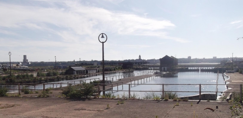
3/308 Graving Docks
-
G.V. II
Graving docks, 1830's. J. Hartley. 2 graving docks with
stepped sides and granite barrel runs. The southern graving
dock of 2 chambers.
Listing NGR: SJ3350491949
External links are from the relevant listing authority and, where applicable, Wikidata. Wikidata IDs may be related buildings as well as this specific building. If you want to add or update a link, you will need to do so by editing the Wikidata entry.


Other nearby listed buildings
