Approximate Location Map
Large Map »
Latitude: 53.0667 / 53°3'59"N
Longitude: -2.5222 / 2°31'19"W
OS Eastings: 365103
OS Northings: 352284
OS Grid: SJ651522
Mapcode National: GBR 7S.BZV3
Mapcode Global: WH9BB.756W
Plus Code: 9C5V3F8H+M4
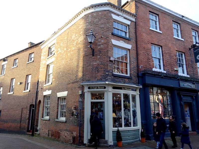
Entry Name: 50, High Street
Listing Date: 1 March 1974
Grade: II
Source: Historic England
Source ID: 1206211
English Heritage Legacy ID: 56623
ID on this website: 101206211
Location: Nantwich, Cheshire East, Cheshire, CW5
County: Cheshire East
Civil Parish: Nantwich
Built-Up Area: Nantwich
Traditional County: Cheshire
Lieutenancy Area (Ceremonial County): Cheshire
Church of England Parish: Nantwich St Mary
Church of England Diocese: Chester
Tagged with: Shop
1.
l425 HIGH STREET
(West Side)
-----------
No 50
SJ 6552 1/97
II GV
2.
Early C19. Red brick; 3 storeys; 1 sash window (lower frame minus glazing bars)
with channelled lintel; wood modillioned eaves; slates. C19 shop front. Returned
side to Mill Street has one sash window.
Nos 42 to 52 (even) form a group.
Listing NGR: SJ6510352284
External links are from the relevant listing authority and, where applicable, Wikidata. Wikidata IDs may be related buildings as well as this specific building. If you want to add or update a link, you will need to do so by editing the Wikidata entry.


Other nearby listed buildings
