Approximate Location Map
Large Map »
Latitude: 52.6394 / 52°38'21"N
Longitude: -2.4939 / 2°29'38"W
OS Eastings: 366671
OS Northings: 304744
OS Grid: SJ666047
Mapcode National: GBR BW.6STY
Mapcode Global: WH9D8.NXMF
Plus Code: 9C4VJGQ4+QC
Entry Name: 3 and 4, Darby Road
Listing Date: 8 April 1983
Grade: II
Source: Historic England
Source ID: 1206272
English Heritage Legacy ID: 361953
ID on this website: 101206272
Location: Coalbrookdale, Telford and Wrekin, Shropshire, TF8
County: Telford and Wrekin
Civil Parish: The Gorge
Built-Up Area: Telford
Traditional County: Shropshire
Lieutenancy Area (Ceremonial County): Shropshire
Church of England Parish: Coalbrookdale
Church of England Diocese: Hereford
Tagged with: Building
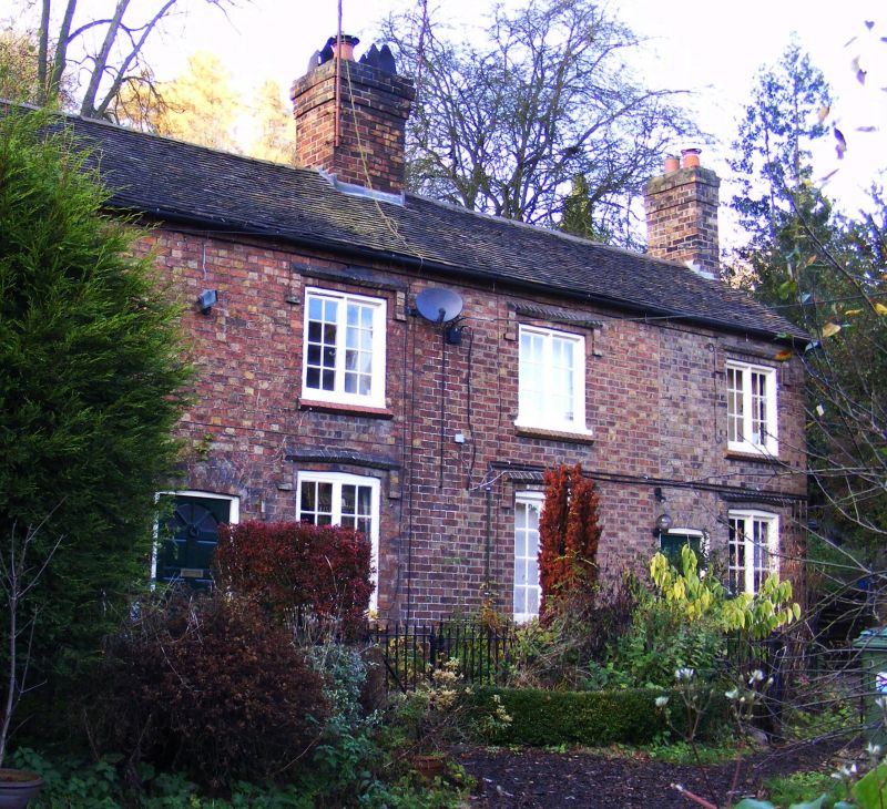
COALBROOKDALE DARBY ROAD
1.
5362 Nos 3 and 4
SJ 6604 9/90
II GV
2.
Mid C19 row of cottages. Red brick. Plain tile roof with gabled ends. Two storeys.
Four window range. Two-light casements with glazing bars and brick dripmoulds. Plain
doorways. Brick ridge stacks. Included for group value.
Listing NGR: SJ6667104744
External links are from the relevant listing authority and, where applicable, Wikidata. Wikidata IDs may be related buildings as well as this specific building. If you want to add or update a link, you will need to do so by editing the Wikidata entry.


Other nearby listed buildings
