Approximate Location Map
Large Map »
Latitude: 52.6316 / 52°37'53"N
Longitude: 1.3039 / 1°18'14"E
OS Eastings: 623680
OS Northings: 308889
OS Grid: TG236088
Mapcode National: GBR WBN.09
Mapcode Global: WHMTN.036V
Plus Code: 9F43J8J3+MH
Entry Name: 45, the Close
Listing Date: 5 June 1972
Grade: II*
Source: Historic England
Source ID: 1206406
English Heritage Legacy ID: 228959
ID on this website: 101206406
Location: The Close, Norwich, Norfolk, NR1
County: Norfolk
District: Norwich
Electoral Ward/Division: Thorpe Hamlet
Parish: Non Civil Parish
Built-Up Area: Norwich
Traditional County: Norfolk
Lieutenancy Area (Ceremonial County): Norfolk
Tagged with: Building
TG 2308 NE THE CLOSE
17/210
5.6.72 No. 45
GV II*
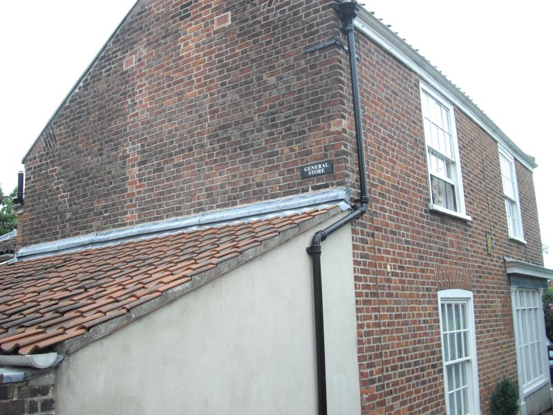
Former bakery, now shop. Early C19. Red brick with pantile roof.
Corner site. 2 storeys. 2 first floor windows on each side.
C19 shopfront on a right-angle with 4 pilasters. Single sash window
with glazing bars and segmental arch on east facade; door in simple
frame and casement window to right on north facade. 2 sash windows
and 2 casement windows at first floor.
Listing NGR: TG2368008889
External links are from the relevant listing authority and, where applicable, Wikidata. Wikidata IDs may be related buildings as well as this specific building. If you want to add or update a link, you will need to do so by editing the Wikidata entry.


Other nearby listed buildings
