Approximate Location Map
Large Map »
Latitude: 52.6328 / 52°37'58"N
Longitude: -2.4718 / 2°28'18"W
OS Eastings: 368167
OS Northings: 304003
OS Grid: SJ681040
Mapcode National: GBR BX.765L
Mapcode Global: WH9DH.027X
Plus Code: 9C4VJGMH+47
Entry Name: The Beacon Public House
Listing Date: 8 April 1983
Grade: II
Source: Historic England
Source ID: 1207739
English Heritage Legacy ID: 362191
ID on this website: 101207739
Location: Woodside, Telford and Wrekin, Shropshire, TF7
County: Telford and Wrekin
Civil Parish: Madeley
Built-Up Area: Telford
Traditional County: Shropshire
Lieutenancy Area (Ceremonial County): Shropshire
Church of England Parish: Ironbridge
Church of England Diocese: Hereford
Tagged with: Pub
IRONBRIDGE MADELEY ROAD
1.
5362
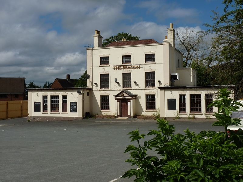
The Beacon Public House
SJ 6803 16/334
II
2.
Late C18 stuccoed Ionic. Hipped tile roof. Parapet with coping, and quoin pilasters.
Three storeys. Three bays. Sashes with glazing bars and voussoired lintels with
keyblocks. Single storey wing to left.
Listing NGR: SJ6816704003
External links are from the relevant listing authority and, where applicable, Wikidata. Wikidata IDs may be related buildings as well as this specific building. If you want to add or update a link, you will need to do so by editing the Wikidata entry.


Other nearby listed buildings
