Approximate Location Map
Large Map »
Latitude: 52.4145 / 52°24'52"N
Longitude: 0.7485 / 0°44'54"E
OS Eastings: 587022
OS Northings: 283166
OS Grid: TL870831
Mapcode National: GBR RD7.Q16
Mapcode Global: VHKCC.XKKW
Plus Code: 9F42CP7X+RC
Entry Name: Garden Wall to King's House
Listing Date: 10 March 1971
Grade: II
Source: Historic England
Source ID: 1207804
English Heritage Legacy ID: 384744
ID on this website: 101207804
Location: Thetford, Breckland, Norfolk, IP24
County: Norfolk
District: Breckland
Civil Parish: Thetford
Built-Up Area: Thetford
Traditional County: Norfolk
Lieutenancy Area (Ceremonial County): Norfolk
Church of England Parish: Thetford St Cuthbert
Church of England Diocese: Norwich
Tagged with: Wall
TL8783
617-1/6/77
10/03/71
THETFORD
KING STREET
(North side)
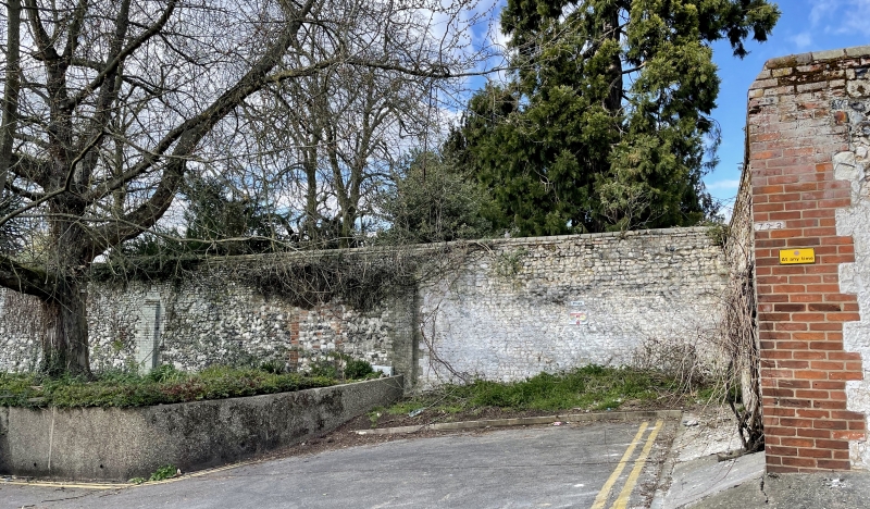
Garden wall to King's House
GV
II
Garden wall. Late C18. Re-used clunch blocks laid in courses
with brick and some re-used ashlar.
Listing NGR: TL8702283166
External links are from the relevant listing authority and, where applicable, Wikidata. Wikidata IDs may be related buildings as well as this specific building. If you want to add or update a link, you will need to do so by editing the Wikidata entry.


Other nearby listed buildings
