Approximate Location Map
Large Map »
Latitude: 51.2132 / 51°12'47"N
Longitude: -3.4749 / 3°28'29"W
OS Eastings: 297074
OS Northings: 147034
OS Grid: SS970470
Mapcode National: GBR LJ.3X1M
Mapcode Global: VH5JY.QR9T
Plus Code: 9C3R6G7G+72
Entry Name: Harbour Cottage
Listing Date: 4 July 1952
Grade: II
Source: Historic England
Source ID: 1207832
English Heritage Legacy ID: 391218
ID on this website: 101207832
Location: Higher Town, Somerset, TA24
County: Somerset
District: Somerset West and Taunton
Civil Parish: Minehead
Built-Up Area: Minehead
Traditional County: Somerset
Lieutenancy Area (Ceremonial County): Somerset
Tagged with: Cottage
MINEHEAD
SS9747 QUAY STREET
900-1/2/67 (West side)
04/07/52 No.55
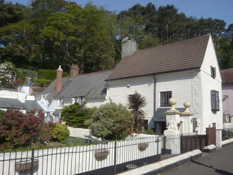
Harbour Cottage
GV II
House, set well back from the street. Late C18. Painted render
over rubblestone, plain tile roof, stack to rear. 2-unit plan
with rear wing. 3 storeys; 2-window range. C20 casement
windows and door to left. INTERIOR not inspected.
Listing NGR: SS9707447034
External links are from the relevant listing authority and, where applicable, Wikidata. Wikidata IDs may be related buildings as well as this specific building. If you want to add or update a link, you will need to do so by editing the Wikidata entry.


Other nearby listed buildings
