Approximate Location Map
Large Map »
Latitude: 51.2059 / 51°12'21"N
Longitude: -3.4813 / 3°28'52"W
OS Eastings: 296612
OS Northings: 146230
OS Grid: SS966462
Mapcode National: GBR LJ.47VX
Mapcode Global: VH5JY.LYXF
Plus Code: 9C3R6G49+9F
Entry Name: 6, the Parks
Listing Date: 28 October 1976
Grade: II
Source: Historic England
Source ID: 1207980
English Heritage Legacy ID: 391250
ID on this website: 101207980
Location: Minehead, Somerset, TA24
County: Somerset
District: Somerset West and Taunton
Civil Parish: Minehead
Built-Up Area: Minehead
Traditional County: Somerset
Lieutenancy Area (Ceremonial County): Somerset
Tagged with: Building
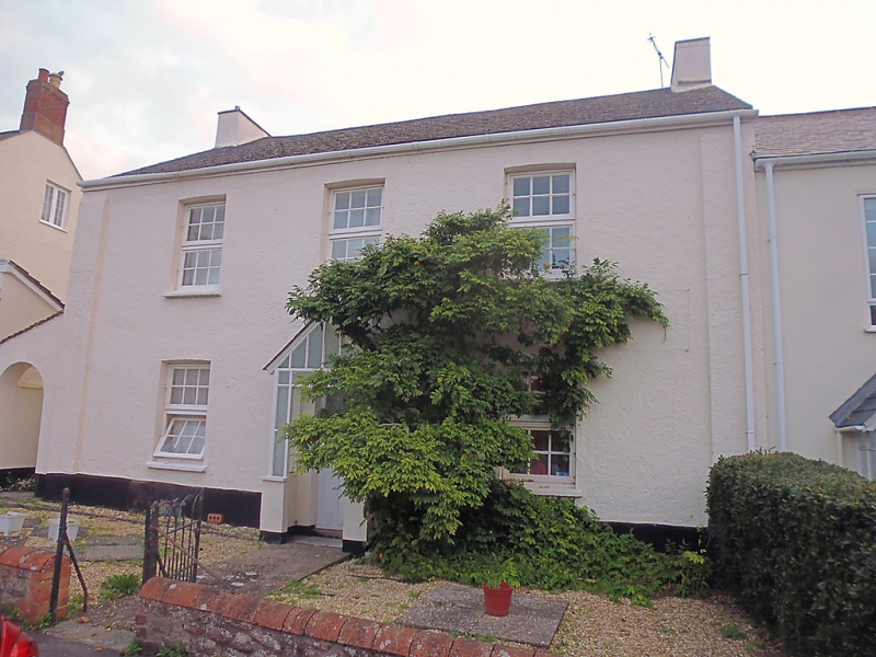
MINEHEAD
SS9646 THE PARKS
900-1/3/91 (North East side)
28/10/76 No.6
GV II
House. Early C19. Stucco, plain tile roof with rendered stacks
to gable ends. Double-depth plan with rear outshut. 2 storeys;
3-window range. Late C20 windows, door and porch. INTERIOR not
inspected. Included for group value.
Listing NGR: SS9661246230
External links are from the relevant listing authority and, where applicable, Wikidata. Wikidata IDs may be related buildings as well as this specific building. If you want to add or update a link, you will need to do so by editing the Wikidata entry.


Other nearby listed buildings
