Approximate Location Map
Large Map »
Latitude: 51.416 / 51°24'57"N
Longitude: -1.5152 / 1°30'54"W
OS Eastings: 433812
OS Northings: 168666
OS Grid: SU338686
Mapcode National: GBR 706.1RZ
Mapcode Global: VHC1S.PNCV
Plus Code: 9C3WCF8M+CW
Entry Name: 7 and 8, High Street
Listing Date: 10 September 1951
Grade: II
Source: Historic England
Source ID: 1210560
English Heritage Legacy ID: 395176
ID on this website: 101210560
Location: Hungerford, West Berkshire, RG17
County: West Berkshire
Civil Parish: Hungerford
Built-Up Area: Hungerford
Traditional County: Berkshire
Lieutenancy Area (Ceremonial County): Berkshire
Church of England Parish: Hungerford with Denford
Church of England Diocese: Oxford
Tagged with: Building
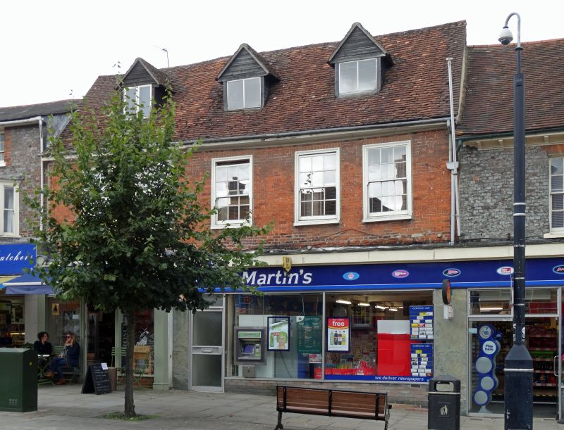
HUNGERFORD HIGH STREET (West side)
SU 3368
18/72 Nos. 7 and 8
10.9.51
G.V. II
House, now house and shops. Circa 1700. Tiled roof, 3 gabled dormers, wide flat
eaves, red brick walls. 2 storeys and attic. 4 glazing bar sashes with
exposed moulded box frames. Modern shop fronts.
Listing NGR: SU3381068676
External links are from the relevant listing authority and, where applicable, Wikidata. Wikidata IDs may be related buildings as well as this specific building. If you want to add or update a link, you will need to do so by editing the Wikidata entry.


Other nearby listed buildings
