Approximate Location Map
Large Map »
Latitude: 51.4897 / 51°29'22"N
Longitude: -0.6092 / 0°36'32"W
OS Eastings: 496660
OS Northings: 177664
OS Grid: SU966776
Mapcode National: GBR F8D.GT1
Mapcode Global: VHFT8.DT9D
Plus Code: 9C3XF9QR+V8
Entry Name: 13 and 14, High Street
Listing Date: 14 May 1973
Grade: II
Source: Historic England
Source ID: 1211011
English Heritage Legacy ID: 395597
ID on this website: 101211011
Location: Eton, Windsor and Maidenhead, Berkshire, SL4
County: Windsor and Maidenhead
Civil Parish: Eton
Built-Up Area: Eton
Traditional County: Buckinghamshire
Lieutenancy Area (Ceremonial County): Berkshire
Church of England Parish: Eton
Church of England Diocese: Oxford
Tagged with: Building
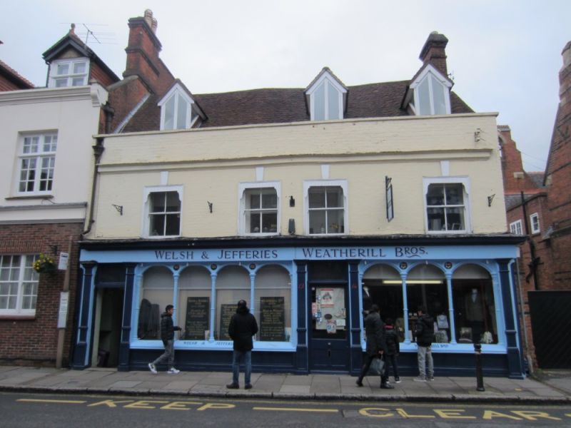
HIGH STREET
1.
1090 (East Side)
Nos 13 and 14
SU 9677 NE 1/11
II
2.
C18 pair of houses with C19 shop front. 2 storeys and attics, 4 double-hung sashes
with flat arches and raised keystones, no glazing bars. Moulded brick cornice,
parapet, machine tile roof with modern chimney stacks and 3 dormers, box. R.C.H.M.
Brick front now painted.
Listing NGR: SU9666177663
External links are from the relevant listing authority and, where applicable, Wikidata. Wikidata IDs may be related buildings as well as this specific building. If you want to add or update a link, you will need to do so by editing the Wikidata entry.


Other nearby listed buildings
