Approximate Location Map
Large Map »
Latitude: 52.4011 / 52°24'3"N
Longitude: -1.9184 / 1°55'6"W
OS Eastings: 405647
OS Northings: 278121
OS Grid: SP056781
Mapcode National: GBR 3GP.FSG
Mapcode Global: VH9Z8.PXN6
Plus Code: 9C4WC32J+CJ
Entry Name: Cart Shed at Walkers Heath Farm
Listing Date: 31 March 1976
Grade: II
Source: Historic England
Source ID: 1211079
English Heritage Legacy ID: 217102
ID on this website: 101211079
Location: King's Norton, Birmingham, West Midlands, B38
County: Birmingham
Parish: Non Civil Parish
Built-Up Area: Birmingham
Traditional County: Worcestershire
Lieutenancy Area (Ceremonial County): West Midlands
Church of England Parish: Kings Norton
Church of England Diocese: Birmingham
Tagged with: Carriage house
GAY HILL LANE
1.
5104
Walkers Heath B39
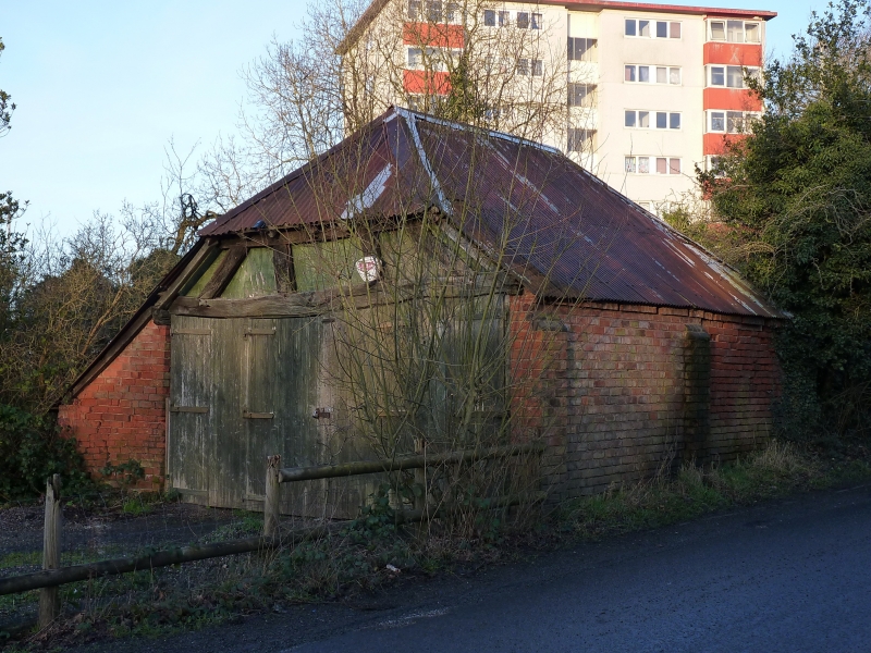
Cart Shed at Walkers Heath
Farm
(formerly listed under
Kings Norton)
SP 07 NE 17/10 31.3.76
II
GV
2.
Probably C18. Two bay cast shed, built of brick, half hipped roof with weather
boarding to gable. Side buttresses.
Listing NGR: SP0564778121
External links are from the relevant listing authority and, where applicable, Wikidata. Wikidata IDs may be related buildings as well as this specific building. If you want to add or update a link, you will need to do so by editing the Wikidata entry.


Other nearby listed buildings
