Approximate Location Map
Large Map »
Latitude: 51.4138 / 51°24'49"N
Longitude: -1.5156 / 1°30'56"W
OS Eastings: 433780
OS Northings: 168422
OS Grid: SU337684
Mapcode National: GBR 706.7NC
Mapcode Global: VHC1S.PQ3J
Plus Code: 9C3WCF7M+GP
Entry Name: 104, High Street
Listing Date: 8 June 1984
Grade: II
Source: Historic England
Source ID: 1211257
English Heritage Legacy ID: 395776
ID on this website: 101211257
Location: Hungerford, West Berkshire, RG17
County: West Berkshire
Civil Parish: Hungerford
Built-Up Area: Hungerford
Traditional County: Berkshire
Lieutenancy Area (Ceremonial County): Berkshire
Church of England Parish: Hungerford with Denford
Church of England Diocese: Oxford
Tagged with: Building
HUNGERFORD HIGH STREET (East side)
SU 3368
18/80 No. 104
G.V. II
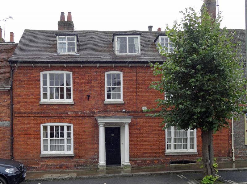
House. Early C19. Tiled roof with 3 flat topped dormers and bracketed
eaves. Red brick, band at first floor, plinth. 2 storeys and attic.
Symmetrical facade. Central, narrow glazing bar sash flanked by tripartite
sashes, plain square central portico with square columns, 6 panel bolection
moulded door.
Listing NGR: SU3378068422
External links are from the relevant listing authority and, where applicable, Wikidata. Wikidata IDs may be related buildings as well as this specific building. If you want to add or update a link, you will need to do so by editing the Wikidata entry.


Other nearby listed buildings
