Approximate Location Map
Large Map »
Latitude: 51.4162 / 51°24'58"N
Longitude: -1.5144 / 1°30'52"W
OS Eastings: 433862
OS Northings: 168690
OS Grid: SU338686
Mapcode National: GBR 706.1YC
Mapcode Global: VHC1S.PNQP
Plus Code: 9C3WCF8P+F6
Entry Name: 130, High Street
Listing Date: 8 June 1984
Grade: II
Source: Historic England
Source ID: 1211295
English Heritage Legacy ID: 395802
ID on this website: 101211295
Location: Hungerford, West Berkshire, RG17
County: West Berkshire
Civil Parish: Hungerford
Built-Up Area: Hungerford
Traditional County: Berkshire
Lieutenancy Area (Ceremonial County): Berkshire
Church of England Parish: Hungerford with Denford
Church of England Diocese: Oxford
Tagged with: Building
HUNGERFORD HIGH STREET (East side)
SU 3368
18/68 No. 130
G.V. II
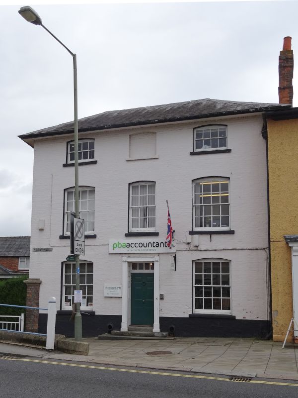
House. C1600, refronted C1830. Slate roof, hipped with overhanging eaves,
painted brick with band at first floor. 3 storeys. 3 glazing bar sashes
with cambered heads, the centre blocked on second floor, central C20 door
with rectangular fanlight in plain reeded surround.
Listing NGR: SU3386268690
External links are from the relevant listing authority and, where applicable, Wikidata. Wikidata IDs may be related buildings as well as this specific building. If you want to add or update a link, you will need to do so by editing the Wikidata entry.


Other nearby listed buildings
