Approximate Location Map
Large Map »
Latitude: 52.0224 / 52°1'20"N
Longitude: -1.0084 / 1°0'30"W
OS Eastings: 468136
OS Northings: 236465
OS Grid: SP681364
Mapcode National: GBR 9XH.3W8
Mapcode Global: VHDT2.GFRG
Plus Code: 9C4W2XCR+XJ
Entry Name: The Kennels
Listing Date: 21 April 1983
Grade: II
Source: Historic England
Source ID: 1211789
English Heritage Legacy ID: 396306
ID on this website: 101211789
Location: Chackmore, Buckinghamshire, MK18
County: Buckinghamshire
Civil Parish: Stowe
Traditional County: Buckinghamshire
Lieutenancy Area (Ceremonial County): Buckinghamshire
Church of England Parish: Stowe
Church of England Diocese: Oxford
Tagged with: Architectural structure
SP 63 NE STOWE
3/98 The Kennels
GV II
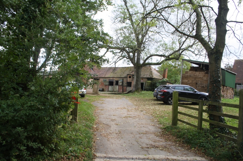
Former smithy, now cottage. C18. Chequered brick, hipped tiled roof.
2 storeys. Right hand bay has cambered arch over carriage entry with
paired casement above. Remainder has,central lobby entry with trellis
porch flanked by paired casements with cambered arches to ground floor.
Single storey lean-to extensions at both ends.
Listing NGR: SP6813636465
External links are from the relevant listing authority and, where applicable, Wikidata. Wikidata IDs may be related buildings as well as this specific building. If you want to add or update a link, you will need to do so by editing the Wikidata entry.


Other nearby listed buildings
