Approximate Location Map
Large Map »
Latitude: 52.0269 / 52°1'36"N
Longitude: -1.0153 / 1°0'55"W
OS Eastings: 467656
OS Northings: 236955
OS Grid: SP676369
Mapcode National: GBR 9X9.VGV
Mapcode Global: VHDT2.CB30
Plus Code: 9C4W2XGM+QV
Entry Name: The Cascade
Listing Date: 13 July 1966
Last Amended: 21 April 1983
Grade: I
Source: Historic England
Source ID: 1211949
English Heritage Legacy ID: 396480
ID on this website: 101211949
Location: Buckinghamshire, MK18
County: Buckinghamshire
Civil Parish: Stowe
Traditional County: Buckinghamshire
Lieutenancy Area (Ceremonial County): Buckinghamshire
Church of England Parish: Stowe
Church of England Diocese: Oxford
Tagged with: Architectural structure
SP 63 NE STOWE
3/83 STOWE SCHOOL
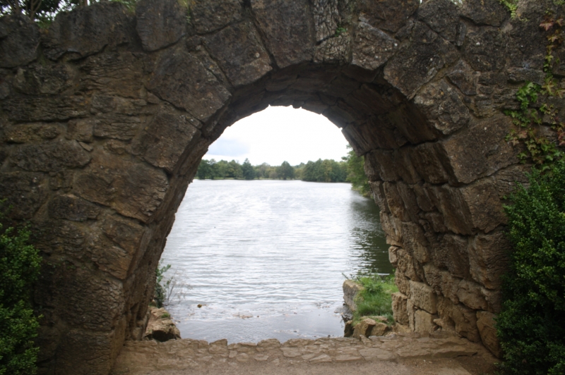
The Cascade
(formerly listed as.
the Rustic Arch between
lakes)
13.7.66
I
Three roughly gothic arches built from large stones between the two main
lakes. Below a further rough segmental stone arch, forming a waterfall.
1760's remodelled early C19.
Listing NGR: SP6765536958
External links are from the relevant listing authority and, where applicable, Wikidata. Wikidata IDs may be related buildings as well as this specific building. If you want to add or update a link, you will need to do so by editing the Wikidata entry.


Other nearby listed buildings
