Approximate Location Map
Large Map »
Latitude: 50.3391 / 50°20'20"N
Longitude: -4.793 / 4°47'34"W
OS Eastings: 201349
OS Northings: 52524
OS Grid: SX013525
Mapcode National: GBR ZX.9QBR
Mapcode Global: FRA 08V4.GKG
Plus Code: 9C2Q86Q4+JQ
Entry Name: 17, North Street
Listing Date: 22 September 1978
Grade: II
Source: Historic England
Source ID: 1212677
English Heritage Legacy ID: 397013
ID on this website: 101212677
Location: St Austell, Cornwall, PL25
County: Cornwall
Civil Parish: St Austell
Built-Up Area: St Austell
Traditional County: Cornwall
Lieutenancy Area (Ceremonial County): Cornwall
Church of England Parish: St Austell
Church of England Diocese: Truro
Tagged with: Building
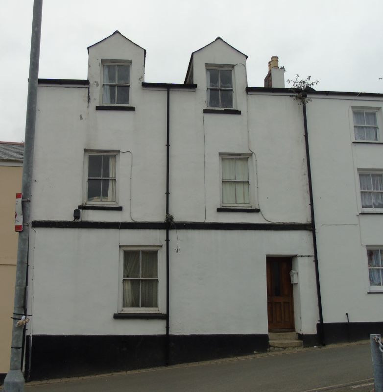
ST AUSTELL
1. NORTH STREET
1584A
No 17
SX 0152 1/512
II
2.
Mid C19. Rendered. Three storeys. Two sash windows with glazing bars. Two
gabled dormers. Slate roof.
Listing NGR: SX0134752522
External links are from the relevant listing authority and, where applicable, Wikidata. Wikidata IDs may be related buildings as well as this specific building. If you want to add or update a link, you will need to do so by editing the Wikidata entry.


Other nearby listed buildings
