Approximate Location Map
Large Map »
Latitude: 51.4342 / 51°26'3"N
Longitude: -1.2062 / 1°12'22"W
OS Eastings: 455273
OS Northings: 170880
OS Grid: SU552708
Mapcode National: GBR 932.1VG
Mapcode Global: VHCZF.16NV
Plus Code: 9C3WCQMV+MG
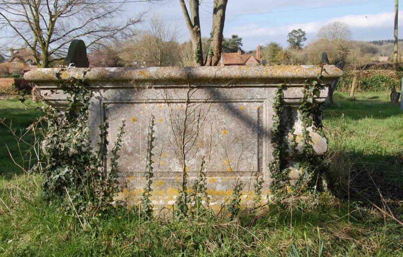
Entry Name: Chest Tomb Approximately 15 Metres to North West of Tower of Church of St Mary
Listing Date: 29 November 1983
Grade: II
Source: Historic England
Source ID: 1212705
English Heritage Legacy ID: 397187
ID on this website: 101212705
Location: St Mary's Church, Bucklebury, West Berkshire, RG7
County: West Berkshire
Civil Parish: Bucklebury
Traditional County: Berkshire
Lieutenancy Area (Ceremonial County): Berkshire
Church of England Parish: Bucklebury
Church of England Diocese: Oxford
Tagged with: Chest tomb
BUCKLEBURY BUCKLEBURY
SU 57 SE
6/17 Chest Tomb
Approximately 15 metres
to North-West of Tower
of Church of St. Mary
GV II
Chest tomb. Early C18. Moulded base and top, shaped corner balusters
and panelled sides. Inscription illegible at time of resurvey.
Listing NGR: SU5526670868
External links are from the relevant listing authority and, where applicable, Wikidata. Wikidata IDs may be related buildings as well as this specific building. If you want to add or update a link, you will need to do so by editing the Wikidata entry.


Other nearby listed buildings
