Approximate Location Map
Large Map »
Latitude: 51.7862 / 51°47'10"N
Longitude: -1.4852 / 1°29'6"W
OS Eastings: 435607
OS Northings: 209847
OS Grid: SP356098
Mapcode National: GBR 6VL.WX6
Mapcode Global: VHC02.6CPL
Plus Code: 9C3WQGP7+FW
Entry Name: 19, High Street
Listing Date: 6 February 1970
Grade: II
Source: Historic England
Source ID: 1213223
English Heritage Legacy ID: 397768
ID on this website: 101213223
Location: Witney, West Oxfordshire, OX28
County: Oxfordshire
District: West Oxfordshire
Civil Parish: Witney
Built-Up Area: Witney
Traditional County: Oxfordshire
Lieutenancy Area (Ceremonial County): Oxfordshire
Church of England Parish: Witney
Church of England Diocese: Oxford
Tagged with: Building
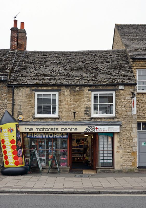
WITNEY HIGH STREET
SP3509N (West side)
10/170 No. 19
06/02/70
GV II
House, now shop. Mid/late C18. Coursed limestone rubble with dressed quoins;
gabled stone slate roof; brick end stack. 2-unit plan. 2 stores; 2-window
range. C20 shop front. Timber lintel over mid C19 three-pane sashes on first
floor. C20 extension to rear. Interior not inspected.
Listing NGR: SP3560709847
External links are from the relevant listing authority and, where applicable, Wikidata. Wikidata IDs may be related buildings as well as this specific building. If you want to add or update a link, you will need to do so by editing the Wikidata entry.


Other nearby listed buildings
