Approximate Location Map
Large Map »
Latitude: 50.7322 / 50°43'56"N
Longitude: -2.7586 / 2°45'30"W
OS Eastings: 346558
OS Northings: 92786
OS Grid: SY465927
Mapcode National: GBR PP.0BYF
Mapcode Global: FRA 5734.P41
Plus Code: 9C2VP6JR+VH
Entry Name: 7 and 9, Gundry Lane
Listing Date: 19 September 1975
Grade: II
Source: Historic England
Source ID: 1216232
English Heritage Legacy ID: 401562
ID on this website: 101216232
Location: Bridport, Dorset, DT6
County: Dorset
Civil Parish: Bridport
Built-Up Area: Bridport
Traditional County: Dorset
Lieutenancy Area (Ceremonial County): Dorset
Church of England Parish: Bridport St Mary
Church of England Diocese: Salisbury
Tagged with: Building
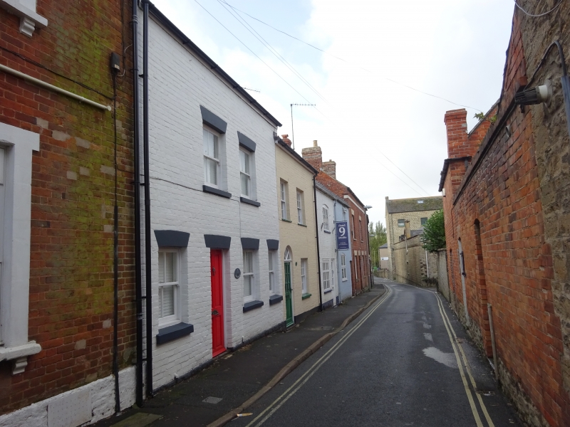
1.
5191 GUNDRY LANE
(South Side)
----------
Nos 7 and 9
SY 4692 1/289
II
2.
Early C19. Colourwashed brick. Pitched slate roof. 2 storeys. No 7 has
2 ranges of sashes with glazing bars, No 9 1 range of casements with glazing
bars. No 7 has modern door with semi-circular fanlight, No 9 a planked door.
Listing NGR: SY4656092787
External links are from the relevant listing authority and, where applicable, Wikidata. Wikidata IDs may be related buildings as well as this specific building. If you want to add or update a link, you will need to do so by editing the Wikidata entry.


Other nearby listed buildings
