Approximate Location Map
Large Map »
Latitude: 51.3514 / 51°21'5"N
Longitude: 0.3197 / 0°19'10"E
OS Eastings: 561629
OS Northings: 163927
OS Grid: TQ616639
Mapcode National: GBR Z1.M81
Mapcode Global: VHHPG.H9CB
Plus Code: 9F329829+HV
Entry Name: Granary to East of Ridley Court Farmhouse
Listing Date: 22 October 1982
Grade: II
Source: Historic England
Source ID: 1216664
English Heritage Legacy ID: 411282
ID on this website: 101216664
Location: Ridley, Sevenoaks, Kent, TN15
County: Kent
District: Sevenoaks
Civil Parish: Ash-cum-Ridley
Traditional County: Kent
Lieutenancy Area (Ceremonial County): Kent
Church of England Parish: Ridley St Peter
Church of England Diocese: Rochester
Tagged with: Granary
1.
5280
TQ 66 SW
7/23
ASH-CUM-RIDLEY
RECTORY ROAD
Ridley
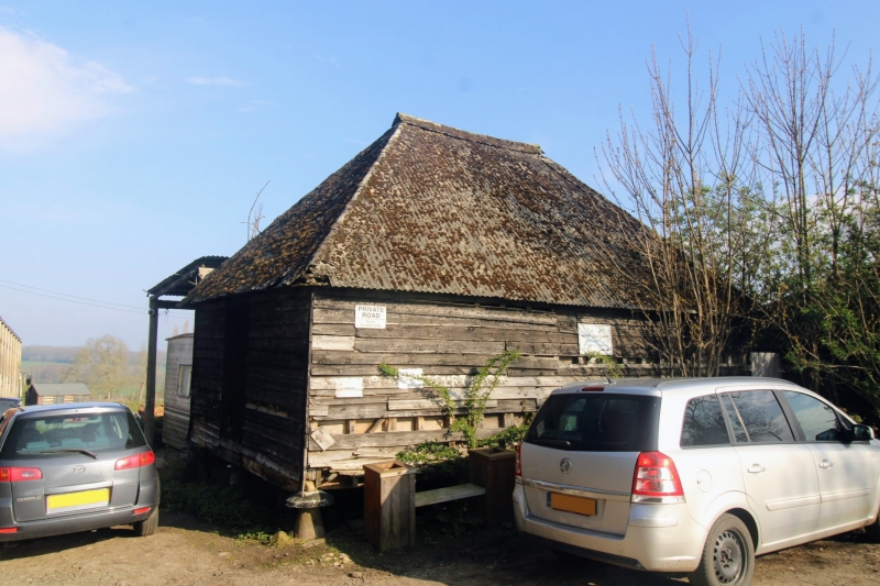
Granary to east of Ridley Court Farmhouse
II
2.
C18. Weatherboarded granary supported on 12 staddle stones. Ripped roof formerly
thatched now covered in asbestos sheeting.
Listing NGR: TQ6162963927
External links are from the relevant listing authority and, where applicable, Wikidata. Wikidata IDs may be related buildings as well as this specific building. If you want to add or update a link, you will need to do so by editing the Wikidata entry.


Other nearby listed buildings
