Approximate Location Map
Large Map »
Latitude: 51.57 / 51°34'11"N
Longitude: -0.7832 / 0°46'59"W
OS Eastings: 484432
OS Northings: 186382
OS Grid: SU844863
Mapcode National: GBR D5W.DTY
Mapcode Global: VHDWB.CSVT
Plus Code: 9C3XH698+XP
Entry Name: See details for further address information
Listing Date: 31 January 1974
Grade: II
Source: Historic England
Source ID: 1217614
English Heritage Legacy ID: 412771
ID on this website: 101217614
Location: Marlow, Buckinghamshire, SL7
County: Buckinghamshire
Civil Parish: Marlow
Built-Up Area: Marlow
Traditional County: Buckinghamshire
Lieutenancy Area (Ceremonial County): Buckinghamshire
Church of England Parish: Great Marlow with Marlow Bottom, Little Marlow and Bisham
Church of England Diocese: Oxford
Tagged with: Building
WEST STREET
1.
1385
(North West Side)
No 118
SU 8486 2/161
II
2.
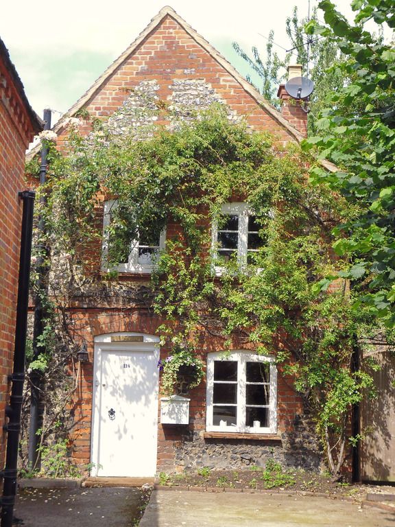
C18 building probably formerly a stable now converted to residential use.
2 storeys, red brick. 2 windows. Casements. Door on left. Gabled red
tile roof.
Listing NGR: SU8443286382
External links are from the relevant listing authority and, where applicable, Wikidata. Wikidata IDs may be related buildings as well as this specific building. If you want to add or update a link, you will need to do so by editing the Wikidata entry.


Other nearby listed buildings
