Approximate Location Map
Large Map »
Latitude: 52.7047 / 52°42'16"N
Longitude: -2.557 / 2°33'25"W
OS Eastings: 362457
OS Northings: 312034
OS Grid: SJ624120
Mapcode National: GBR BS.2P61
Mapcode Global: WH9D1.P8KW
Plus Code: 9C4VPC3V+V5
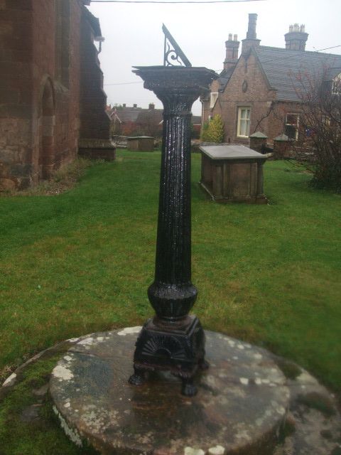
Entry Name: Sundial in Churchyard South West of Church of St Peter
Listing Date: 8 April 1983
Grade: II
Source: Historic England
Source ID: 1217993
English Heritage Legacy ID: 362516
ID on this website: 101217993
Location: St Peter's Church, Wrockwardine, Telford and Wrekin, Shropshire, TF6
County: Telford and Wrekin
Civil Parish: Wrockwardine
Traditional County: Shropshire
Lieutenancy Area (Ceremonial County): Shropshire
Church of England Parish: Wrockwardine St Peter
Church of England Diocese: Lichfield
Tagged with: Sundial
1.
5362
SJ 6212
3/659
WROCKWARDINE
WROCKWARDINE
Sundial in churchyard south-west of Church of St Peter
II
GV
2.
Dated 1750, a bronze sundial mounted on C19 cast iron fluted column on a circular
stone base.
Listing NGR: SJ6245712034
External links are from the relevant listing authority and, where applicable, Wikidata. Wikidata IDs may be related buildings as well as this specific building. If you want to add or update a link, you will need to do so by editing the Wikidata entry.


Other nearby listed buildings
