Approximate Location Map
Large Map »
Latitude: 51.2889 / 51°17'20"N
Longitude: 0.4033 / 0°24'11"E
OS Eastings: 567681
OS Northings: 157163
OS Grid: TQ676571
Mapcode National: GBR NPK.0SV
Mapcode Global: VHJM4.YV2S
Plus Code: 9F327CQ3+H8
Entry Name: Old Gatepiers to Malling Place
Listing Date: 30 November 1993
Grade: II
Source: Historic England
Source ID: 1219072
English Heritage Legacy ID: 392444
ID on this website: 101219072
Location: St Leonard's Street, Tonbridge and Malling, Kent, ME19
County: Kent
District: Tonbridge and Malling
Civil Parish: West Malling
Traditional County: Kent
Lieutenancy Area (Ceremonial County): Kent
Church of England Parish: West Malling St Mary
Church of England Diocese: Rochester
Tagged with: Architectural structure
TQ6757
1156-0/2/127
WEST MALLING
ST LEONARDS STREET
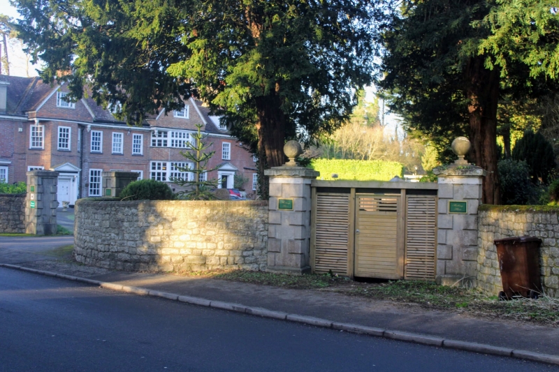
Old Gatepiers to Malling Place
GV
II
Gatepiers. Early C19. Pair of cemented rusticated piers about
2.5m high with moulded cornices, plinths and tooled ball
finials.
Listing NGR: TQ6768157163
External links are from the relevant listing authority and, where applicable, Wikidata. Wikidata IDs may be related buildings as well as this specific building. If you want to add or update a link, you will need to do so by editing the Wikidata entry.


Other nearby listed buildings
