Approximate Location Map
Large Map »
Latitude: 50.1178 / 50°7'4"N
Longitude: -5.5339 / 5°32'2"W
OS Eastings: 147472
OS Northings: 30171
OS Grid: SW474301
Mapcode National: GBR DXQC.MYT
Mapcode Global: VH12Z.199K
Plus Code: 9C2P4F98+4C
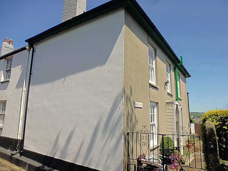
Entry Name: 4, Abbey Street
Listing Date: 7 February 1974
Grade: II
Source: Historic England
Source ID: 1219815
English Heritage Legacy ID: 69405
ID on this website: 101219815
Location: Penzance, Cornwall, TR18
County: Cornwall
Civil Parish: Penzance
Built-Up Area: Penzance
Traditional County: Cornwall
Lieutenancy Area (Ceremonial County): Cornwall
Church of England Parish: Penzance St Mary the Virgin with St Paul
Church of England Diocese: Truro
Tagged with: Building
1.
1498 PENZANCE
ABBEY STREET
No 4
SW 4730 5/449
II GV
2.
Early C19. Stucco. 2 storeys. 3 windows, sashes with glazing bars. Central
doorway, rectangular fanlight and shallow wood trellis porch. Slate hipped roof,
wide eaves. To right wing, 2 storeys, one window, doorway with simple hood.
No 4 together with Nos 20 to 24 (consec) New Street form a group.
Listing NGR: SW4747230171
External links are from the relevant listing authority and, where applicable, Wikidata. Wikidata IDs may be related buildings as well as this specific building. If you want to add or update a link, you will need to do so by editing the Wikidata entry.


Other nearby listed buildings
