Approximate Location Map
Large Map »
Latitude: 54.1332 / 54°7'59"N
Longitude: -0.7972 / 0°47'49"W
OS Eastings: 478689
OS Northings: 471485
OS Grid: SE786714
Mapcode National: GBR QNWN.63
Mapcode Global: WHFBG.QCLR
Plus Code: 9C6X46M3+74
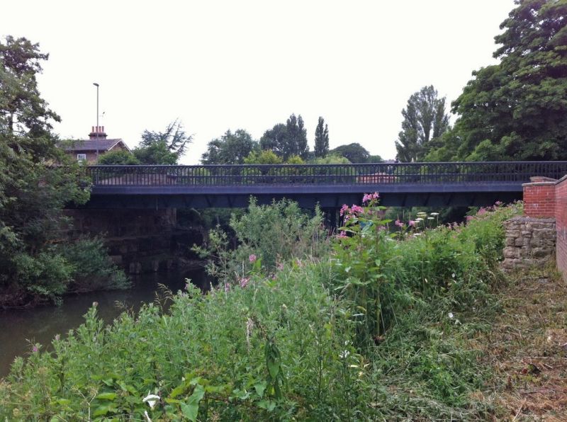
Entry Name: Railway Bridge
Listing Date: 5 April 1993
Grade: II
Source: Historic England
Source ID: 1220026
English Heritage Legacy ID: 389505
ID on this website: 101220026
Location: Malton, North Yorkshire, YO17
County: North Yorkshire
District: Ryedale
Civil Parish: Malton
Built-Up Area: Malton
Traditional County: Yorkshire
Lieutenancy Area (Ceremonial County): North Yorkshire
Church of England Parish: New Malton St Michael
Church of England Diocese: York
Tagged with: Railway bridge
MALTON
SE78717971 RAILWAY STREET
801-1/7/123 Railway Bridge
GV II
Railway bridge. c1860. Cast-iron bridge between rusticated
sandstone abutments. Flat 2-span bridge carried on 6
transverse Tuscan columns. Abutments have cornice band beneath
plain parapet with flat coping. Bridge has arcaded balustrade
with shaped coping.
Listing NGR: SE7868971486
External links are from the relevant listing authority and, where applicable, Wikidata. Wikidata IDs may be related buildings as well as this specific building. If you want to add or update a link, you will need to do so by editing the Wikidata entry.


Other nearby listed buildings
