Approximate Location Map
Large Map »
Latitude: 51.4787 / 51°28'43"N
Longitude: -1.3184 / 1°19'6"W
OS Eastings: 447432
OS Northings: 175751
OS Grid: SU474757
Mapcode National: GBR 810.9HL
Mapcode Global: VHCZ5.33C7
Plus Code: 9C3WFMHJ+FJ
Entry Name: Elmgrove
Listing Date: 16 August 1983
Grade: II
Source: Historic England
Source ID: 1220172
English Heritage Legacy ID: 393963
ID on this website: 101220172
Location: Downend, West Berkshire, RG20
County: West Berkshire
Civil Parish: Chieveley
Built-Up Area: Chieveley
Traditional County: Berkshire
Lieutenancy Area (Ceremonial County): Berkshire
Church of England Parish: Chieveley with Winterbourne and Oare
Church of England Diocese: Oxford
Tagged with: Building
SU 47NE CHIEVELEY NORTHFIELDS
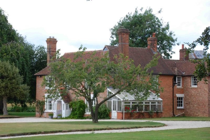
2/1 Elmgrove
- II
House. Late C18. Red brick and old tile hipped roof with end stacks to
left and right. 2 storeys. 3 bays. Glazing bar sashes. Tripartite sashes with
deep lintels in first and third bays. Central door with C19 gabled timber
porch.
Listing NGR: SU4743275751
External links are from the relevant listing authority and, where applicable, Wikidata. Wikidata IDs may be related buildings as well as this specific building. If you want to add or update a link, you will need to do so by editing the Wikidata entry.


Other nearby listed buildings
