Approximate Location Map
Large Map »
Latitude: 51.4156 / 51°24'56"N
Longitude: -1.3338 / 1°20'1"W
OS Eastings: 446423
OS Northings: 168719
OS Grid: SU464687
Mapcode National: GBR 81R.5LM
Mapcode Global: VHCZB.TPQ5
Plus Code: 9C3WCM88+6F
Entry Name: The Old Tannery
Listing Date: 9 September 1969
Grade: II
Source: Historic England
Source ID: 1220545
English Heritage Legacy ID: 394174
ID on this website: 101220545
Location: Donnington, West Berkshire, RG14
County: West Berkshire
Civil Parish: Shaw cum Donnington
Built-Up Area: Newbury
Traditional County: Berkshire
Lieutenancy Area (Ceremonial County): Berkshire
Church of England Parish: Shaw cum Donnington
Church of England Diocese: Oxford
Tagged with: Architectural structure
SU 46NE SHAW CUM DONNINGTON DONNINGTON
7/71 The Old Tannery
9.9.G9
GV II
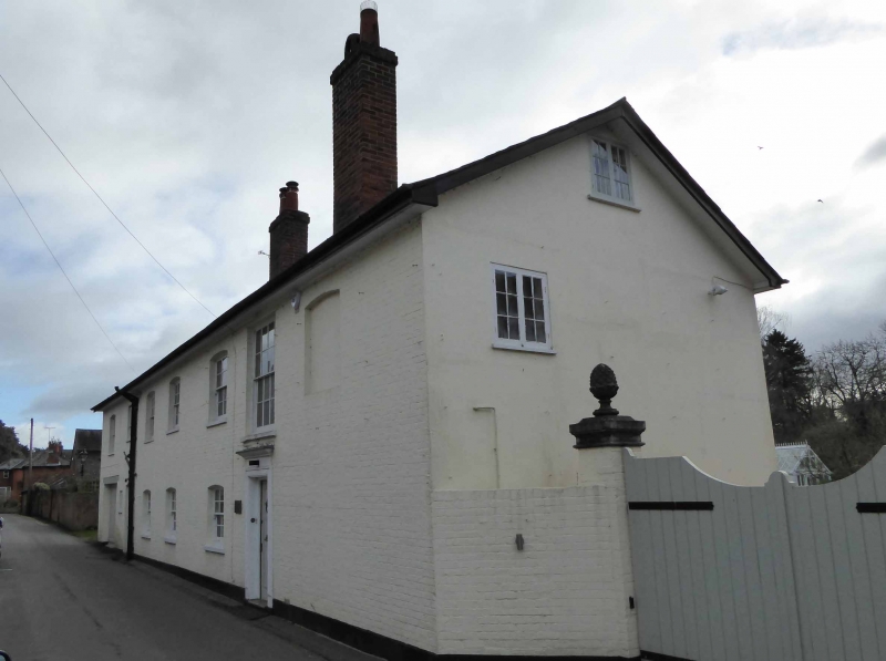
Tannery, now house. Early C19. Painted brick with slate roof and 3
Stacks. 2 storeys. 6 window front, with glazing bar sashes; panelled door
to right with architrave and flat hood.
Listing NGR: SU4642368719
External links are from the relevant listing authority and, where applicable, Wikidata. Wikidata IDs may be related buildings as well as this specific building. If you want to add or update a link, you will need to do so by editing the Wikidata entry.


Other nearby listed buildings
