Approximate Location Map
Large Map »
Latitude: 51.4099 / 51°24'35"N
Longitude: -1.3474 / 1°20'50"W
OS Eastings: 445482
OS Northings: 168079
OS Grid: SU454680
Mapcode National: GBR 81R.G59
Mapcode Global: VHCZB.LTJJ
Plus Code: 9C3WCM53+X2
Entry Name: Granary at Speen Farm
Listing Date: 6 April 1967
Grade: II
Source: Historic England
Source ID: 1220788
English Heritage Legacy ID: 394441
ID on this website: 101220788
Location: Speen, West Berkshire, RG14
County: West Berkshire
Civil Parish: Speen
Built-Up Area: Newbury
Traditional County: Berkshire
Lieutenancy Area (Ceremonial County): Berkshire
Church of England Parish: Speen
Church of England Diocese: Oxford
Tagged with: Granary
SU 46NE SPEEN SPEEN LANE
(south west side)
7/18 Granary At Speen Farm
6.4.G7
GV II
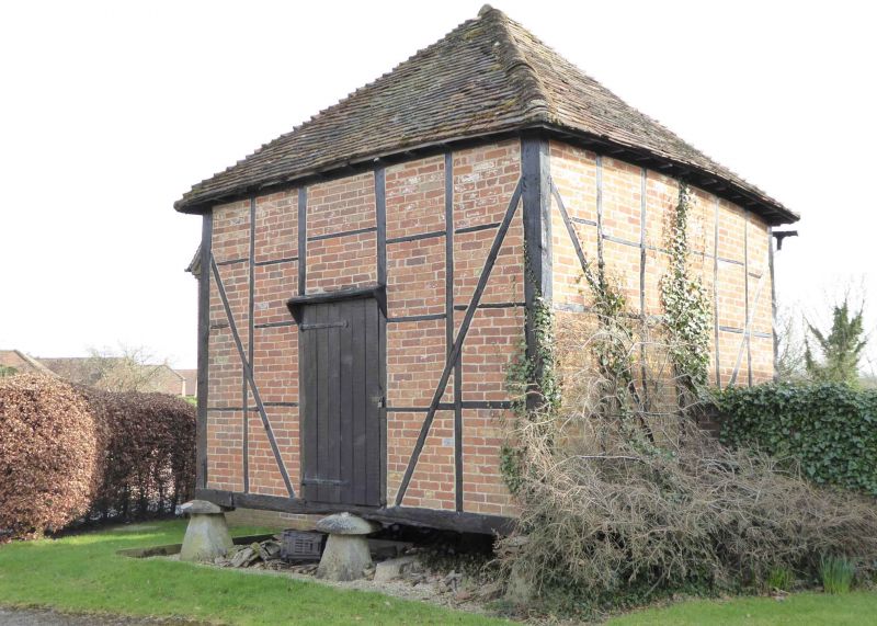
Granary. C17 or C18. Timber framed with brick nogging and hipped old tile roof.
9 staddlestones. Entrance to north.
Listing NGR: SU4548268078
External links are from the relevant listing authority and, where applicable, Wikidata. Wikidata IDs may be related buildings as well as this specific building. If you want to add or update a link, you will need to do so by editing the Wikidata entry.


Other nearby listed buildings
