Approximate Location Map
Large Map »
Latitude: 51.3929 / 51°23'34"N
Longitude: -1.3156 / 1°18'56"W
OS Eastings: 447712
OS Northings: 166201
OS Grid: SU477662
Mapcode National: GBR 81Z.Q5P
Mapcode Global: VHCZK.48T2
Plus Code: 9C3W9MVM+4P
Entry Name: 99, Greenham Road
Listing Date: 2 September 1983
Grade: II
Source: Historic England
Source ID: 1221041
English Heritage Legacy ID: 394716
ID on this website: 101221041
Location: East Fields, West Berkshire, RG14
County: West Berkshire
Civil Parish: Newbury
Built-Up Area: Newbury
Traditional County: Berkshire
Lieutenancy Area (Ceremonial County): Berkshire
Church of England Parish: Greenham
Church of England Diocese: Oxford
Tagged with: Building
1. GREENHAM ROAD
5127
No 99
SU 46 NE 1/86
II GV
2.
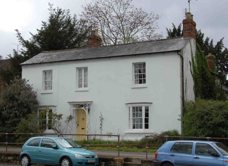
Early C19 villa (before 1837). Two storeys. Double fronted with 3 windows.
Slate roof. Stucco. Recessed sash windows with glazing bars. Splayed ground
floor bay windows. Doorway with original cast iron trellis porch.
Listing NGR: SU4771266201
External links are from the relevant listing authority and, where applicable, Wikidata. Wikidata IDs may be related buildings as well as this specific building. If you want to add or update a link, you will need to do so by editing the Wikidata entry.


Other nearby listed buildings
